
Size of this preview:
800 × 480 pixels. Other resolutions:
320 × 192 pixels |
1,041 × 625 pixels.
Original file (1,041 × 625 pixels, file size: 235 KB, MIME type: image/jpeg)
| This is a file from the
Wikimedia Commons. Information from its
description page there is shown below. Commons is a freely licensed media file repository. You can help. |
|
This is an image of a place or building that is listed on the
National Register of Historic Places in the
United States of America. Its reference number is
4001413. |
Summary
| Description |
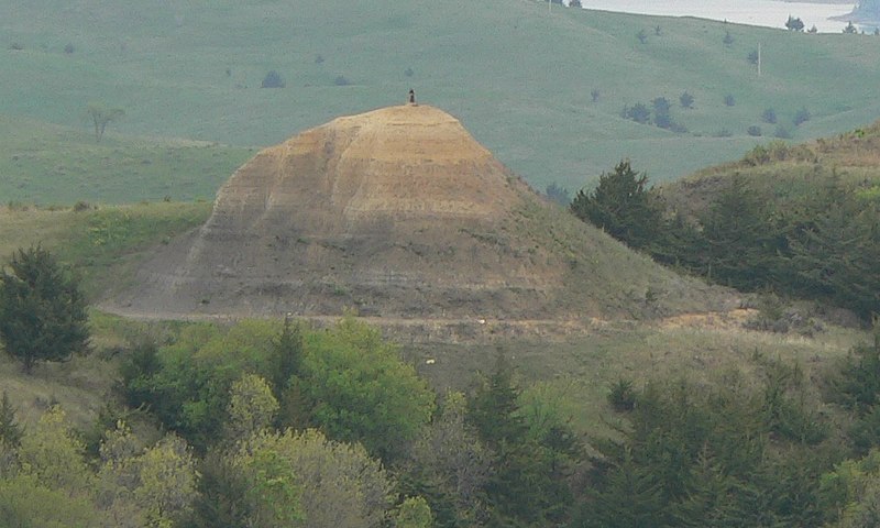
English:
The Tower, a landform north of
Lynch in
Boyd County, Nebraska; seen from an overlook to the south. It is listed in the
National Register of Historic Places because of its association with the
Lewis and Clark Expedition. The
Missouri River is visible in the upper right corner of the photo. |
| Date | |
| Source | Own work |
| Author | Ammodramus |
| Camera location |
| View this and other nearby images on: OpenStreetMap |
|
|---|
Licensing
| I, the copyright holder of this work, release this work into the
public domain. This applies worldwide. In some countries this may not be legally possible; if so: I grant anyone the right to use this work for any purpose, without any conditions, unless such conditions are required by law. |
File history
Click on a date/time to view the file as it appeared at that time.
| Date/Time | Thumbnail | Dimensions | User | Comment | |
|---|---|---|---|---|---|
| current | 21:27, 14 May 2010 |
| 1,041 × 625 (235 KB) | Ammodramus | {{Information |Description={{en|1= The Tower, a landform north of Lynch in {{w|Boyd County, Nebraska}}; seen from an overlook to the south. It is listed in the {{w|National Register of Historic Pla |
File usage
The following pages on the English Wikipedia use this file (pages on other projects are not listed):
Global file usage
The following other wikis use this file:
- Usage on de.wikipedia.org
- Usage on es.wikipedia.org