Original file (2,862 × 1,890 pixels, file size: 3.84 MB, MIME type: image/jpeg)
| This is a file from the
Wikimedia Commons. Information from its
description page there is shown below. Commons is a freely licensed media file repository. You can help. |
Summary
|
This is an image of a place or building that is listed on the
National Register of Historic Places in the
United States of America. Its reference number is
5000097. |
| Description |
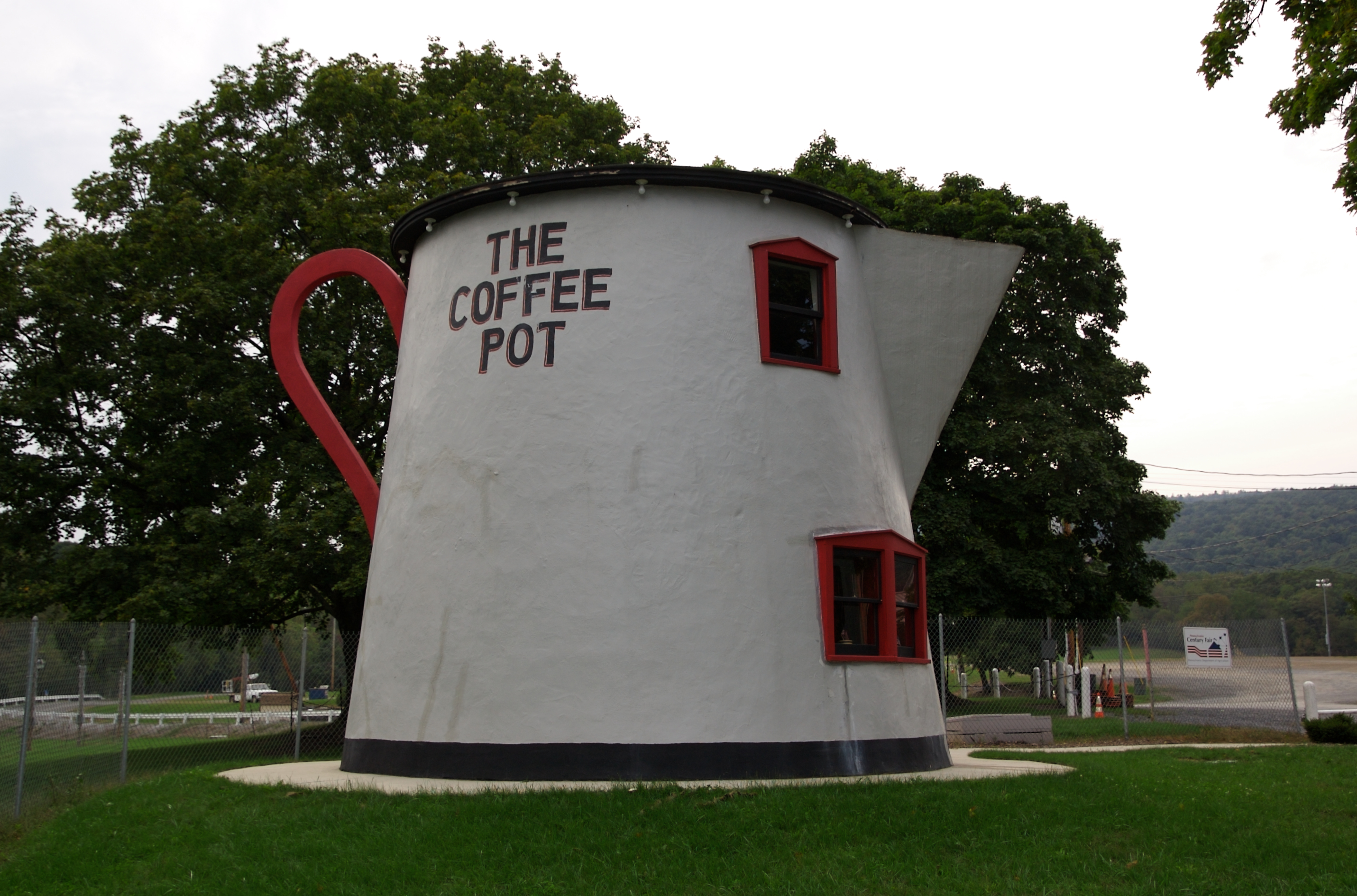
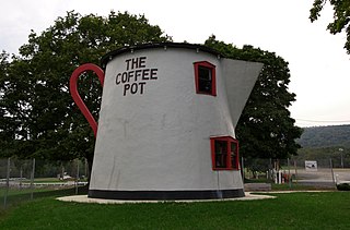
From the exhibit sign: The increased number of automobiles during the Lincoln Highway era (1912-1940) led to the development of programmatic architecture. Proprietors took daring approaches to appeal to the new motoring public. All across the country, over-sized buildings were being created in the likeness of objects. Some of the more famous were constructed in Pennsylvania along the Lincoln Highway route -- the Coffee Pot, the Ship Hotel, the Shoe House, etc. Many have fallen into disrepair. In 1927, Bert Koontz designed and quickly erected the Coffee Pot on the wend end of Bedford. His intention was to attract visitors to his adjacent gas station. The early restaurant served ice cream, hamburgers and Coca=Cola. In 1937 it was converted to a bar and a hotel was built in the rear. The Coffee Pot became a regular stop for Greyhound bus passengers since the bus depot was next door. In an effort to save the Coffee Pot, the Lincoln Highway Heritage Corridor moved it to this location and restored it in 2004. |
| Date | Taken on 20 September 2008, 14:46 |
| Source | The Coffee Pot (Bedford, Pennsylvania) |
| Author | Jeff Kubina from Columbia, Maryland |
| Camera location |
| View this and other nearby images on: OpenStreetMap |
|
|---|
Licensing
- You are free:
- to share – to copy, distribute and transmit the work
- to remix – to adapt the work
- Under the following conditions:
- attribution – You must give appropriate credit, provide a link to the license, and indicate if changes were made. You may do so in any reasonable manner, but not in any way that suggests the licensor endorses you or your use.
- share alike – If you remix, transform, or build upon the material, you must distribute your contributions under the same or compatible license as the original.
| This image, originally posted to Flickr, was reviewed on October 6, 2008 by the administrator or reviewer File Upload Bot (Magnus Manske), who confirmed that it was available on Flickr under the stated license on that date. |
File history
Click on a date/time to view the file as it appeared at that time.
| Date/Time | Thumbnail | Dimensions | User | Comment | |
|---|---|---|---|---|---|
| current | 02:04, 6 October 2008 |
| 2,862 × 1,890 (3.84 MB) | File Upload Bot (Magnus Manske) | {{Information |Description= From the exhibit sign: The increased number of automobiles during the Lincoln Highway era (1912-1940) led to the development of programmatic architecture. Proprietors took daring approaches to appeal to the new motoring public |
File usage
Global file usage
The following other wikis use this file:
- Usage on de.wikivoyage.org
- Usage on no.wikipedia.org
- Usage on sv.wikipedia.org
- Usage on tl.wikipedia.org
- Usage on www.wikidata.org