
Size of this preview:
507 × 599 pixels. Other resolutions:
203 × 240 pixels |
406 × 480 pixels |
650 × 768 pixels |
867 × 1,024 pixels |
1,734 × 2,048 pixels |
3,084 × 3,643 pixels.
Original file (3,084 × 3,643 pixels, file size: 3.38 MB, MIME type: image/jpeg)
| This is a file from the
Wikimedia Commons. Information from its
description page there is shown below. Commons is a freely licensed media file repository. You can help. |
Summary
|
This is an image of a place or building that is listed on the
National Register of Historic Places in the
United States of America. Its reference number is
74002074. |
| Description |
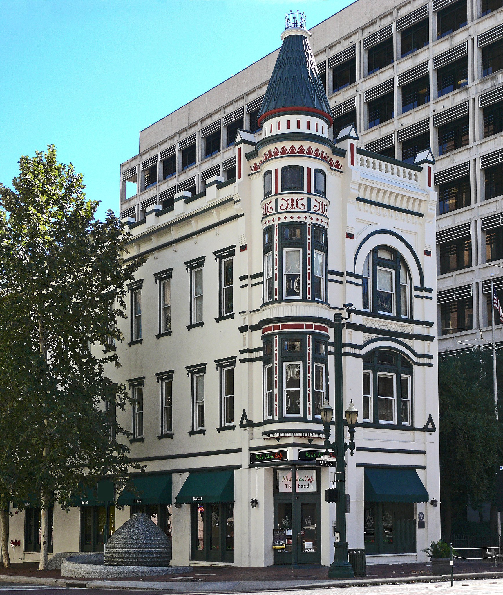
English: This late-Victorian commercial building with a 3-story corner turret and Eastlake decorative elements was designed by George E. Dickey in 1889. Evidence indicates that the 1889 construction may have been a renovation of an 1861 structure built by William A. Van Alstyne and purchased in 1882 by John Jasper Sweeney and Edward L. Coombs. Gus Fredericks joined the Sweeney and Coombs Jewelry firm before 1889. Coordinates N 29° 45.724 W 095° 21.644 |
| Date | |
| Source | Own work |
| Author | i_am_jim |
| Camera location |
| View this and other nearby images on: OpenStreetMap |
|
|---|
Licensing
I, the copyright holder of this work, hereby publish it under the following license:
This file is licensed under the
Creative Commons
Attribution-Share Alike 3.0 Unported license.
- You are free:
- to share – to copy, distribute and transmit the work
- to remix – to adapt the work
- Under the following conditions:
- attribution – You must give appropriate credit, provide a link to the license, and indicate if changes were made. You may do so in any reasonable manner, but not in any way that suggests the licensor endorses you or your use.
- share alike – If you remix, transform, or build upon the material, you must distribute your contributions under the same or compatible license as the original.

|
This image has been assessed under the valued image criteria and is considered the most valued image on Commons within the scope: Sweeney, Coombs, and Fredericks Building. You can see its nomination here. |
File history
Click on a date/time to view the file as it appeared at that time.
| Date/Time | Thumbnail | Dimensions | User | Comment | |
|---|---|---|---|---|---|
| current | 23:29, 5 March 2019 |
| 3,084 × 3,643 (3.38 MB) | Jim Evans | larger image |
| 00:58, 11 November 2012 |
 | 1,354 × 1,600 (1.01 MB) | Wiki name~commonswiki | User created page with UploadWizard |
File usage
The following pages on the English Wikipedia use this file (pages on other projects are not listed):
Global file usage
The following other wikis use this file:
- Usage on de.wikipedia.org
- Usage on www.wikidata.org