
Size of this preview:
800 × 476 pixels. Other resolutions:
320 × 191 pixels |
640 × 381 pixels |
1,024 × 610 pixels |
1,280 × 762 pixels |
2,560 × 1,525 pixels |
3,842 × 2,288 pixels.
Original file (3,842 × 2,288 pixels, file size: 4.24 MB, MIME type: image/jpeg)
| This is a file from the
Wikimedia Commons. Information from its
description page there is shown below. Commons is a freely licensed media file repository. You can help. |
Summary
| Description |
There are no known copyright restrictions on this image. All future uses of this photo should include the courtesy line, "Photo courtesy Orange County Archives." Comments are welcome after reading our Comment Policy. Photo from the Tom Pulley Collection. |
| Date | |
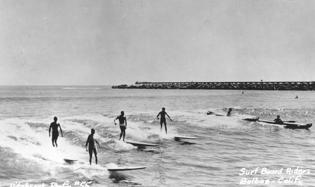
| Source | Surfing, Corona Del Mar, circa 1950s |
| Author | Orange County Archives from Orange County, California, United States of America |
| Camera location |
| View this and other nearby images on: OpenStreetMap |
|
|---|
Licensing
This file is licensed under the
Creative Commons
Attribution 2.0 Generic license.
- You are free:
- to share – to copy, distribute and transmit the work
- to remix – to adapt the work
- Under the following conditions:
- attribution – You must give appropriate credit, provide a link to the license, and indicate if changes were made. You may do so in any reasonable manner, but not in any way that suggests the licensor endorses you or your use.
| This image was originally posted to Flickr by Orange County Archives at https://www.flickr.com/photos/30346812@N07/8291373047. It was reviewed on 25 October 2013 by FlickreviewR and was confirmed to be licensed under the terms of the cc-by-2.0. |
File history
Click on a date/time to view the file as it appeared at that time.
| Date/Time | Thumbnail | Dimensions | User | Comment | |
|---|---|---|---|---|---|
| current | 19:34, 25 October 2013 |
| 3,842 × 2,288 (4.24 MB) | Richard apple | {{Information |Description=There are no known copyright restrictions on this image. All future uses of this photo should include the courtesy line, "Photo courtesy Orange County Archives." Comments are welcome after reading our [http://egov.ocgov.com/... |
File usage
No pages on the English Wikipedia use this file (pages on other projects are not listed).