
Size of this preview:
800 × 530 pixels. Other resolutions:
320 × 212 pixels |
640 × 424 pixels |
1,024 × 678 pixels |
1,280 × 848 pixels |
2,560 × 1,696 pixels |
4,928 × 3,264 pixels.
Original file (4,928 × 3,264 pixels, file size: 13.19 MB, MIME type: image/jpeg)
| This is a file from the
Wikimedia Commons. Information from its
description page there is shown below. Commons is a freely licensed media file repository. You can help. |
Summary
| Description |
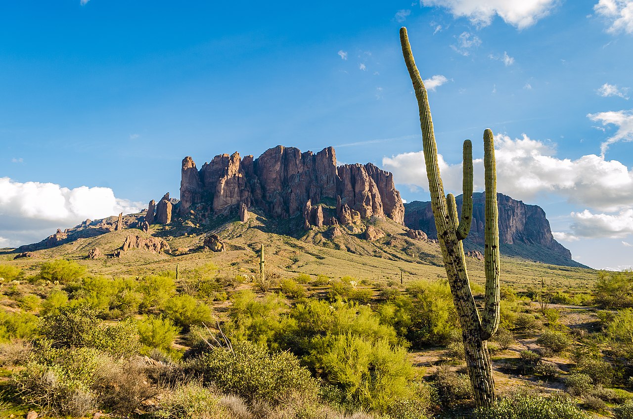
English: The Superstition Mointain rises some 3,000 feet above the surrounding desert floor and dominates the eastern fringe of the Salt River Valley. The mountain is part of the Superstition Winderness Area which contains some 159,780 acres or 242 sq. miles of the Tonto National Forest and includes a wide-range of flora indigenous to the Sonoran Desert like giant Saguaro cactus, Desert Broom, Red Yucca, Cholla. |
| Date | Taken on 2 December 2018, 15:43:33 |
| Source | Own work |
| Author | lydia_pirate |
Licensing
I, the copyright holder of this work, hereby publish it under the following license:
This file is licensed under the
Creative Commons
Attribution-Share Alike 4.0 International license.
- You are free:
- to share – to copy, distribute and transmit the work
- to remix – to adapt the work
- Under the following conditions:
- attribution – You must give appropriate credit, provide a link to the license, and indicate if changes were made. You may do so in any reasonable manner, but not in any way that suggests the licensor endorses you or your use.
- share alike – If you remix, transform, or build upon the material, you must distribute your contributions under the same or compatible license as the original.
File history
Click on a date/time to view the file as it appeared at that time.
| Date/Time | Thumbnail | Dimensions | User | Comment | |
|---|---|---|---|---|---|
| current | 04:46, 26 April 2020 |
| 4,928 × 3,264 (13.19 MB) | KaHa6uc | Uploaded own work with UploadWizard |
File usage
No pages on the English Wikipedia use this file (pages on other projects are not listed).