
Size of this preview:
800 × 524 pixels. Other resolutions:
320 × 210 pixels |
640 × 420 pixels |
1,080 × 708 pixels.
Original file (1,080 × 708 pixels, file size: 746 KB, MIME type: image/jpeg)
| This is a file from the
Wikimedia Commons. Information from its
description page there is shown below. Commons is a freely licensed media file repository. You can help. |
Summary
| Description |
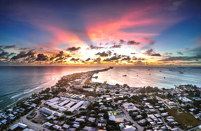
English: Sunset in Majuro, over Delap-Uliga-Darrit in the Marshall Islands from a drone.
Français : Coucher de soleil à Majuro, au dessus de Delap-Uliga-Darrit dans les Îles Marshall depuis un drone. |
| Date | |
| Source | ticket:2018050110004488 |
| Author | Jamison Logan |
| Permission ( Reusing this file) |
|
| Other versions |
.jpg)
| Camera location |
| View this and other nearby images on: OpenStreetMap |
|
|---|
Licensing
This file is licensed under the
Creative Commons
Attribution-Share Alike 4.0 International license.
- You are free:
- to share – to copy, distribute and transmit the work
- to remix – to adapt the work
- Under the following conditions:
- attribution – You must give appropriate credit, provide a link to the license, and indicate if changes were made. You may do so in any reasonable manner, but not in any way that suggests the licensor endorses you or your use.
- share alike – If you remix, transform, or build upon the material, you must distribute your contributions under the same or compatible license as the original.
File history
Click on a date/time to view the file as it appeared at that time.
| Date/Time | Thumbnail | Dimensions | User | Comment | |
|---|---|---|---|---|---|
| current | 15:04, 2 May 2018 |
| 1,080 × 708 (746 KB) | Bastenbas | User created page with UploadWizard |
File usage
The following pages on the English Wikipedia use this file (pages on other projects are not listed):
Global file usage
The following other wikis use this file:
- Usage on ary.wikipedia.org
- Usage on bn.wikipedia.org
- Usage on en.wikivoyage.org
- Usage on es.wikivoyage.org
- Usage on fr.wikipedia.org
- Usage on hi.wikipedia.org
- Usage on hr.wikipedia.org
- Usage on id.wikipedia.org
- Usage on incubator.wikimedia.org
- Usage on it.wikivoyage.org
- Usage on ja.wikipedia.org
- Usage on ml.wikipedia.org
- Usage on pl.wikipedia.org
- Usage on sat.wikipedia.org
- Usage on sd.wikipedia.org
- Usage on sk.wikipedia.org
- Usage on sr.wikipedia.org
- Usage on sv.wikipedia.org
- Usage on to.wikipedia.org
- Usage on vec.wikipedia.org
- Usage on vep.wikipedia.org
- Usage on xmf.wikipedia.org
- Usage on zh.wikipedia.org