
Size of this preview:
800 × 518 pixels. Other resolutions:
320 × 207 pixels |
640 × 415 pixels |
1,024 × 663 pixels |
1,280 × 829 pixels |
1,786 × 1,157 pixels.
Original file (1,786 × 1,157 pixels, file size: 791 KB, MIME type: image/jpeg)
| This is a file from the
Wikimedia Commons. Information from its
description page there is shown below. Commons is a freely licensed media file repository. You can help. |
|
This is an image of a place or building that is listed on the
National Register of Historic Places in the
United States of America. Its reference number is
4000619. |
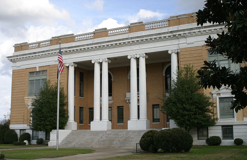
| Description |
English: Sumter County Courthouse in
Sumter County, South Carolina, USA. |
||||||||
| Date | 2 December 2006 (original upload date) | ||||||||
| Source | Transferred from en.wikipedia to Commons by Leoboudv using CommonsHelper. | ||||||||
| Author | The original uploader was Pollinator at English Wikipedia. | ||||||||
| Permission ( Reusing this file) |
Pollinator at the
English-language Wikipedia, the copyright holder of this work, hereby publishes it under the following license:
|

| Object location |
| View this and other nearby images on: OpenStreetMap |
|
|---|
Original upload log
The original description page was
here. All following user names refer to en.wikipedia.
- 2006-12-02 06:11 Pollinator 1786×1157× (809739 bytes) Sumter County Courthouse, [[Sumter, South Carolina]]
File history
Click on a date/time to view the file as it appeared at that time.
| Date/Time | Thumbnail | Dimensions | User | Comment | |
|---|---|---|---|---|---|
| current | 06:58, 20 June 2009 |
| 1,786 × 1,157 (791 KB) | File Upload Bot (Magnus Manske) | {{BotMoveToCommons|en.wikipedia|year={{subst:CURRENTYEAR}}|month={{subst:CURRENTMONTHNAME}}|day={{subst:CURRENTDAY}}}} {{Information |Description={{en|Sumter County Courthouse in Sumter County, South Carolina, USA.}} |Sourc |
File usage
The following pages on the English Wikipedia use this file (pages on other projects are not listed):
Global file usage
The following other wikis use this file:
- Usage on ar.wikipedia.org
- Usage on ceb.wikipedia.org
- Usage on ce.wikipedia.org
- Usage on cy.wikipedia.org
- Usage on fa.wikipedia.org
- Usage on fr.wikipedia.org
- Usage on ga.wikipedia.org
- Usage on hu.wikipedia.org
- Usage on hy.wikipedia.org
- Usage on it.wikipedia.org
- Usage on ja.wikipedia.org
- Usage on ko.wikipedia.org
- Usage on nl.wikipedia.org
- Usage on no.wikipedia.org
- Usage on pl.wikipedia.org
- Usage on ro.wikipedia.org
- Usage on ru.wikipedia.org
- Usage on simple.wikipedia.org
- Usage on sr.wikipedia.org
- Usage on sv.wikipedia.org
- Usage on tr.wikipedia.org
- Usage on tt.wikipedia.org
- Usage on ur.wikipedia.org
- Usage on www.wikidata.org
- Usage on zh-min-nan.wikipedia.org