
Size of this preview:
800 × 532 pixels. Other resolutions:
320 × 213 pixels |
640 × 425 pixels |
1,024 × 681 pixels |
1,280 × 851 pixels |
2,843 × 1,890 pixels.
Original file (2,843 × 1,890 pixels, file size: 3.84 MB, MIME type: image/jpeg)
| This is a file from the
Wikimedia Commons. Information from its
description page there is shown below. Commons is a freely licensed media file repository. You can help. |
Summary
| Description |
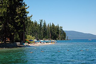
English: People on the beach at
Lake Tahoe, at the
Sugar Pine Point State Park, California. The wooden structure on the left is the North Boat House. |
| Date | Taken on 25 July 2011, 22:34:18 |
| Source | Own work |
| Author | DimiTalen ( talk · contribs) |
| Camera location | | View this and other nearby images on: OpenStreetMap |
|
|---|
Licensing
I, the copyright holder of this work, hereby publish it under the following license:
This file is licensed under the
Creative Commons
Attribution-Share Alike 3.0 Unported license.
- You are free:
- to share – to copy, distribute and transmit the work
- to remix – to adapt the work
- Under the following conditions:
- attribution – You must give appropriate credit, provide a link to the license, and indicate if changes were made. You may do so in any reasonable manner, but not in any way that suggests the licensor endorses you or your use.
- share alike – If you remix, transform, or build upon the material, you must distribute your contributions under the same or compatible license as the original.
This image has been assessed using the
Quality image guidelines and is considered a
Quality image.
|
File history
Click on a date/time to view the file as it appeared at that time.
| Date/Time | Thumbnail | Dimensions | User | Comment | |
|---|---|---|---|---|---|
| current | 16:25, 1 November 2012 |
| 2,843 × 1,890 (3.84 MB) | DimiTalen | User created page with UploadWizard |
File usage
The following pages on the English Wikipedia use this file (pages on other projects are not listed):
Global file usage
The following other wikis use this file:
- Usage on ceb.wikipedia.org
- Usage on cs.wikipedia.org
- Usage on en.wikivoyage.org
- Usage on fr.wikipedia.org
- Usage on id.wikipedia.org
- Usage on ml.wikipedia.org
- Usage on mr.wikipedia.org
- Usage on nl.wikipedia.org
- Usage on ur.wikipedia.org
- Usage on www.wikidata.org
- Usage on zh-yue.wikipedia.org
- Usage on zh.wikipedia.org