
Size of this preview:
800 × 567 pixels. Other resolutions:
320 × 227 pixels |
640 × 454 pixels |
1,024 × 726 pixels |
1,151 × 816 pixels.
Original file (1,151 × 816 pixels, file size: 267 KB, MIME type: image/jpeg)
| This is a file from the
Wikimedia Commons. Information from its
description page there is shown below. Commons is a freely licensed media file repository. You can help. |
Summary
| Description |
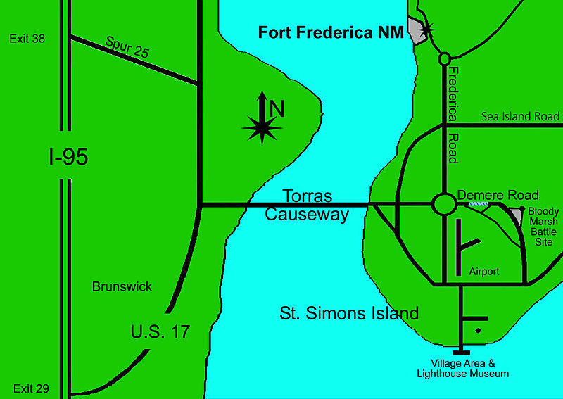
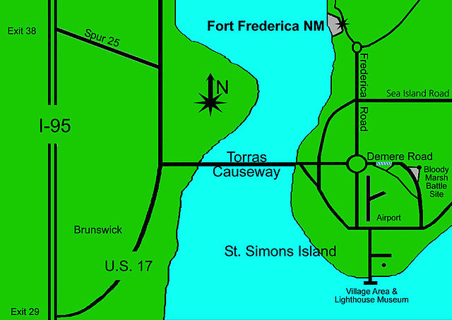
English: Map showing part of
St. Simons Island |
| Source | US National Park Service http://www.nps.gov/fofr/planyourvisit/bloodymarshunit.htm |
| Author | US National Park Service |
Licensing
| This image or media file contains material based on a work of a National Park Service employee, created as part of that person's official duties. As a work of the U.S. federal government, such work is in the public domain in the United States. See the NPS website and NPS copyright policy for more information. |
Original upload log
Transferred from en.wikipedia to Commons by Fredlyfish4 using CommonsHelper.
The original description page was
here. All following user names refer to en.wikipedia.
- 2010-02-21 05:32 Bubba73 1151×816× (273545 bytes) {{Information |Description = Map showing part of [[St. Simons Island]] |Source = NPS http://www.nps.gov/fofr/planyourvisit/bloodymarshunit.htm |Date = ~~~~~ |Author = US National Park Service |Permission = |other_ve
File history
Click on a date/time to view the file as it appeared at that time.
| Date/Time | Thumbnail | Dimensions | User | Comment | |
|---|---|---|---|---|---|
| current | 18:23, 8 October 2012 |
| 1,151 × 816 (267 KB) | File Upload Bot (Magnus Manske) | Transfered from en.wikipedia by User:Fredlyfish4 using CommonsHelper |
File usage
The following pages on the English Wikipedia use this file (pages on other projects are not listed):
Global file usage
The following other wikis use this file:
- Usage on ja.wikipedia.org