Size of this preview:
469 × 599 pixels. Other resolutions:
188 × 240 pixels |
376 × 480 pixels |
601 × 768 pixels |
802 × 1,024 pixels |
1,604 × 2,048 pixels |
2,920 × 3,728 pixels.
Original file (2,920 × 3,728 pixels, file size: 2.38 MB, MIME type: image/jpeg)
| This is a file from the
Wikimedia Commons. Information from its
description page there is shown below. Commons is a freely licensed media file repository. You can help. |
Summary
| Description |
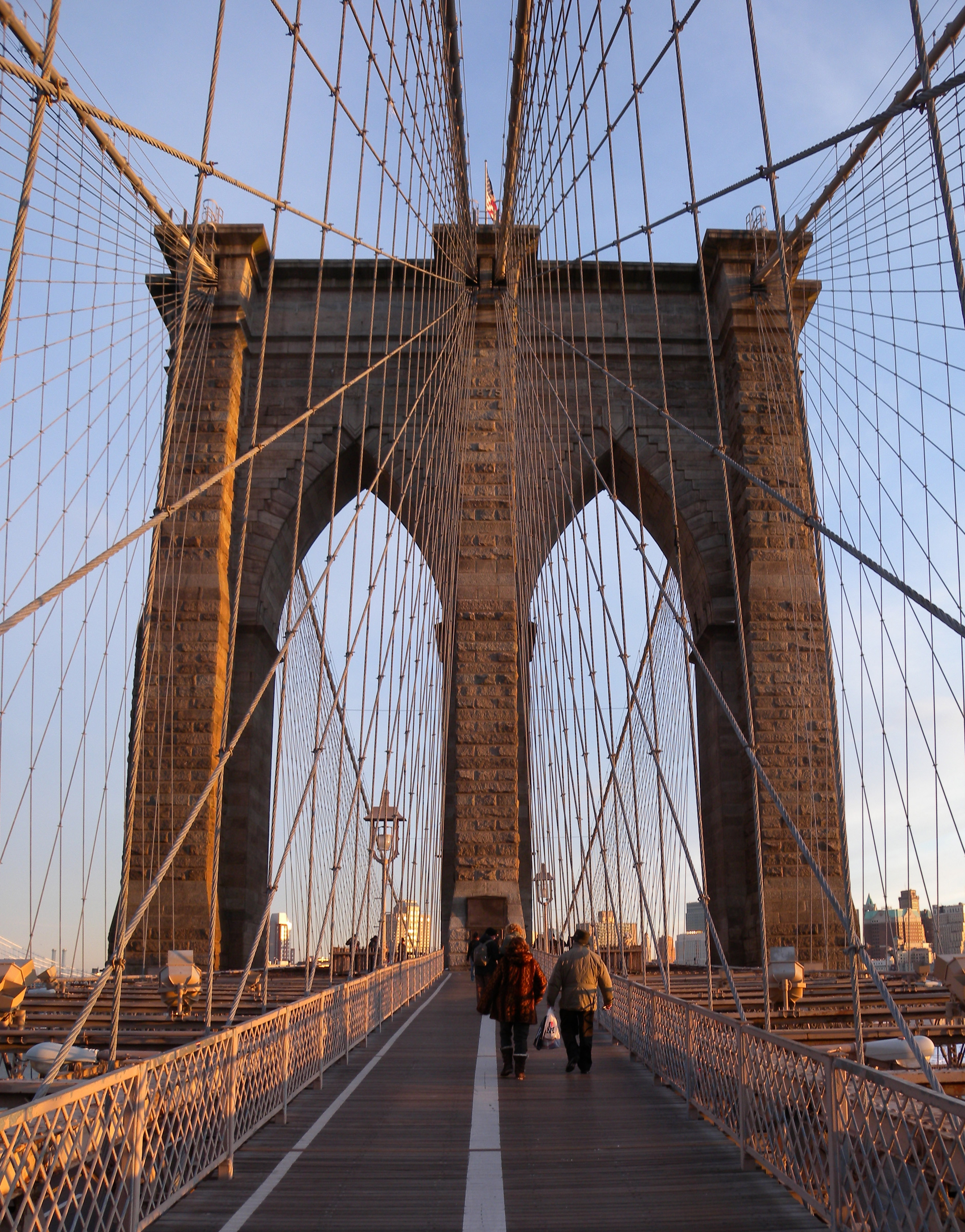
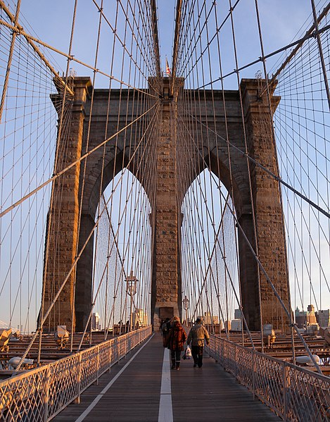
English: Looking southeast along centerline of Brooklyn Bridge shortly before dusk of a sunny day. |
| Date | Taken on 20 December 2009 |
| Source | Own work |
| Author | Jim.henderson |
| Camera location | | View this and other nearby images on: OpenStreetMap |
|
|---|
Licensing
| This file is made available under the Creative Commons CC0 1.0 Universal Public Domain Dedication. | |
| The person who associated a work with this deed has dedicated the work to the
public domain by waiving all of their rights to the work worldwide under copyright law, including all related and neighboring rights, to the extent allowed by law. You can copy, modify, distribute and perform the work, even for commercial purposes, all without asking permission.
|
File history
Click on a date/time to view the file as it appeared at that time.
| Date/Time | Thumbnail | Dimensions | User | Comment | |
|---|---|---|---|---|---|
| current | 01:22, 9 January 2010 |
| 2,920 × 3,728 (2.38 MB) | Jim.henderson | {{Information |Description={{en|1=Looking southeast along centerline of Brooklyn Bridge shortly before dusk of a sunny day.}} |Source=Own work |Author= Jim.henderson |Date=2009-12-20 |Permission= |other_versions= }} [[Category:Brook |
File usage
The following pages on the English Wikipedia use this file (pages on other projects are not listed):
- Long Island
- New York City
- Timeline of Brooklyn
- User:Chronus/sandbox
- User:KrakatoaKatie/CalendarJanuary
- User:SunriseInBrooklyn/sandbox4
- User:SunriseInBrooklyn/sandbox4/Intro
- Wikipedia:Main Page history/2014 May 24
- Wikipedia:Main Page history/2016 May 24
- Wikipedia:Main Page history/2017 May 24
- Wikipedia:Main Page history/2018 May 24
- Wikipedia:Selected anniversaries/May 24
Global file usage
The following other wikis use this file:
- Usage on as.wikipedia.org
- Usage on bh.wikipedia.org
- Usage on bn.wikipedia.org
- Usage on et.wikipedia.org
- Usage on fa.wikipedia.org
- Usage on hy.wikipedia.org
- Usage on ja.wikipedia.org
- Usage on kn.wikipedia.org
- Usage on lo.wikipedia.org
- Usage on pt.wikipedia.org
- Usage on sco.wikipedia.org
- Usage on simple.wikipedia.org
- Usage on sl.wikipedia.org
- Usage on sv.wikipedia.org
- Usage on th.wikipedia.org
- Usage on tl.wikipedia.org
- Usage on tr.wikipedia.org
- Usage on tum.wikipedia.org
- Usage on vi.wikipedia.org
- Usage on zh-min-nan.wikipedia.org
- Usage on zh.wikipedia.org