Original file (848 × 706 pixels, file size: 923 KB, MIME type: image/png)
| This is a file from the
Wikimedia Commons. Information from its
description page there is shown below. Commons is a freely licensed media file repository. You can help. |
Summary
| Description |
English: From:
http://www.nasa.gov/mission_pages/NPP/news/earth-at-night.html
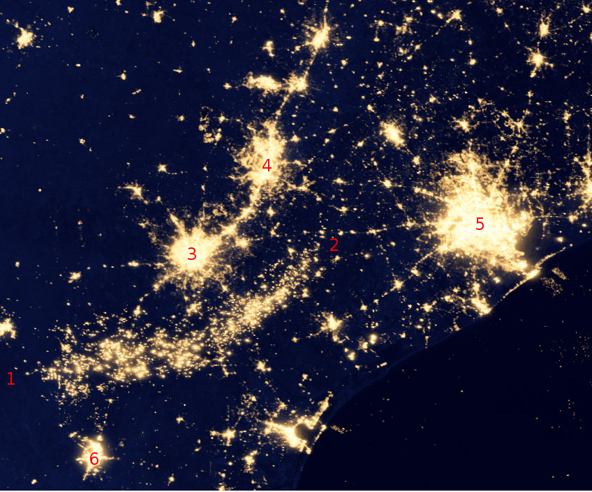
This image of the continental United States at night is a composite assembled from data acquired by the Suomi NPP satellite in April and October 2012. The image was made possible by the satellite's "day-night band" of the Visible Infrared Imaging Radiometer Suite (VIIRS), which detects light in a range of wavelengths from green to near-infrared and uses filtering techniques to observe dim signals such as city lights, gas flares, auroras, wildfires and reflected moonlight. Annotations added by User:Beland following information from: http://geology.com/articles/oil-fields-from-space/
|
| Date | |
| Source | http://www.nasa.gov/sites/default/files/images/712129main_8247975848_88635d38a1_o.jpg |
| Author | NASA Earth Observatory/NOAA NGDC |
Licensing
| This file is in the public domain in the United States because it was solely created by NASA. NASA copyright policy states that "NASA material is not protected by copyright unless noted". (See Template:PD-USGov, NASA copyright policy page or JPL Image Use Policy.) | ||
 |
Warnings:
|
File history
Click on a date/time to view the file as it appeared at that time.
| Date/Time | Thumbnail | Dimensions | User | Comment | |
|---|---|---|---|---|---|
| current | 19:48, 29 January 2015 |
| 848 × 706 (923 KB) | Beland | User created page with UploadWizard |
File usage
Global file usage
The following other wikis use this file:
- Usage on vi.wikipedia.org