
Original file (2,304 × 3,072 pixels, file size: 4.36 MB, MIME type: image/jpeg)
| This is a file from the
Wikimedia Commons. Information from its
description page there is shown below. Commons is a freely licensed media file repository. You can help. |
Summary
| Description |
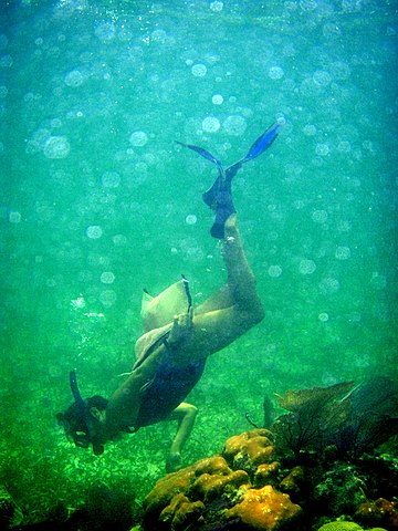
English: snorkeling belize reefs - Guide Kathy Cure from Oceanic Society Research Station in Blackbird Caye, Belize 2008 April
More images at picasaweb.google.com/mikebaird/20080429BelizeUnderwaterSw... We regret to inform you that we cannot accept your submission, entitled Female Snorkeling in Belize ( www1.istockphoto.com/file_thumbview_approve/7065308/2/ist... for addition to the iStockphoto library for the following reasons: This file contains artifacting when viewed at full size. This technical issue is commonly created by the quality settings in-camera, in post-processing or in RAWsettings. Artifacting may be the result of other factors such as excessive level adjustments.... This file contains an excess of pixel discoloration when viewed at 100%, which we felt too severe and would affect the quality of print production.
LicensingThis file is licensed under the
Creative Commons
Attribution 2.0 Generic license.
|
||||||
| Date |
08:23 |
||||||
| Source | snorkeling belize reefs - Kat Cure Guide in Belize 2008 Oceanic Society | ||||||
| Author | Mike Baird |
)
Licensing
| This image was originally posted to Flickr by mikebaird at https://www.flickr.com/photos/72825507@N00/2487686431. It was reviewed on 12 March 2013 by FlickreviewR and was confirmed to be licensed under the terms of the cc-by-2.0. |
- You are free:
- to share – to copy, distribute and transmit the work
- to remix – to adapt the work
- Under the following conditions:
- attribution – You must give appropriate credit, provide a link to the license, and indicate if changes were made. You may do so in any reasonable manner, but not in any way that suggests the licensor endorses you or your use.
- share alike – If you remix, transform, or build upon the material, you must distribute your contributions under the same or compatible license as the original.
File history
Click on a date/time to view the file as it appeared at that time.
| Date/Time | Thumbnail | Dimensions | User | Comment | |
|---|---|---|---|---|---|
| current | 15:35, 12 March 2013 |
| 2,304 × 3,072 (4.36 MB) | Pgbk1987 | User created page with UploadWizard |
File usage
Global file usage
The following other wikis use this file:
- Usage on ar.wikipedia.org
- Usage on bg.wikipedia.org
- Usage on fa.wikipedia.org
- Usage on fr.wikipedia.org
- Usage on mt.wikipedia.org
- Usage on sl.wikipedia.org
- Usage on tr.wikipedia.org