
Size of this preview:
800 × 400 pixels. Other resolutions:
320 × 160 pixels |
640 × 320 pixels |
1,024 × 512 pixels |
1,800 × 900 pixels.
Original file (1,800 × 900 pixels, file size: 1.44 MB, MIME type: image/jpeg)
| This is a file from the
Wikimedia Commons. Information from its
description page there is shown below. Commons is a freely licensed media file repository. You can help. |
,_Municipality_of_San_Carlos,_Tamaulipas,_Mexico_(12_July_2007).jpg)
Summary
| Description |
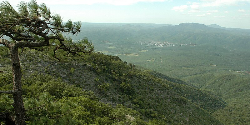
English: This photo was taken in the Sierra San Carlos near Bufa El Diente, looking north to the town of San Carlos (seen just right of center in mid-ground), and a pine tree (Pinus teocote) growing on the left. Municipality of San Carlos, Tamaulipas, Mexico (24.5299°N, 98.9586°W, 1060 m. elev.). Photographed on 12 July 07 by William L. Farr. |
| Date | |
| Source | Own work |
| Author | William L. Farr |
Licensing
I, the copyright holder of this work, hereby publish it under the following license:
This file is licensed under the
Creative Commons
Attribution-Share Alike 4.0 International license.
- You are free:
- to share – to copy, distribute and transmit the work
- to remix – to adapt the work
- Under the following conditions:
- attribution – You must give appropriate credit, provide a link to the license, and indicate if changes were made. You may do so in any reasonable manner, but not in any way that suggests the licensor endorses you or your use.
- share alike – If you remix, transform, or build upon the material, you must distribute your contributions under the same or compatible license as the original.
File history
Click on a date/time to view the file as it appeared at that time.
| Date/Time | Thumbnail | Dimensions | User | Comment | |
|---|---|---|---|---|---|
| current | 03:46, 12 July 2020 |
| 1,800 × 900 (1.44 MB) | Wilafa | Uploaded own work with UploadWizard |
File usage
The following pages on the English Wikipedia use this file (pages on other projects are not listed):
,_Municipality_of_San_Carlos,_Tamaulipas,_Mexico_(12_July_2007).jpg)