
Size of this preview:
800 × 600 pixels. Other resolutions:
320 × 240 pixels |
640 × 480 pixels |
1,024 × 768 pixels |
1,259 × 944 pixels.
Original file (1,259 × 944 pixels, file size: 1.19 MB, MIME type: image/png)
| This is a file from the
Wikimedia Commons. Information from its
description page there is shown below. Commons is a freely licensed media file repository. You can help. |
| Description |
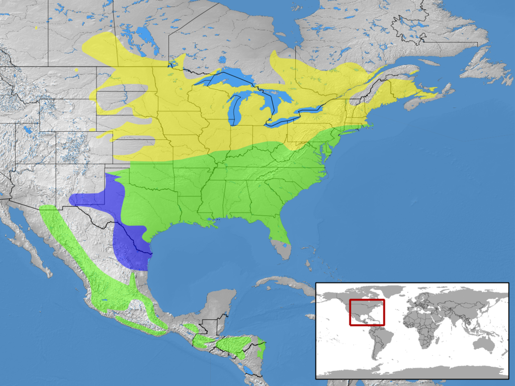
English: geographic distribution of Sialia sialis
|
| Date | |
| Source | own work, based on Natural Earth Free vector and raster map data and Nature Serve Distribution Maps of the Birds of the Western Hemisphere |
| Author |
|
| Permission ( Reusing this file) |
This file is licensed under the
Creative Commons
Attribution-Share Alike 3.0 Unported license. Attribution: rbrausse
|
| Other versions |
|

File history
Click on a date/time to view the file as it appeared at that time.
| Date/Time | Thumbnail | Dimensions | User | Comment | |
|---|---|---|---|---|---|
| current | 10:14, 10 April 2013 |
| 1,259 × 944 (1.19 MB) | Rbrausse | {{Information |Description ={{en|1=geographic distribution of ''Sialia mexicana'' * Yellow: Native (breeding seasons only) * Blue: Native (nonbreeding seasons only) * Green: Native (year round)}} |Source =own work, based on Natural Earth Fre... |
File usage
The following pages on the English Wikipedia use this file (pages on other projects are not listed):
Global file usage
The following other wikis use this file:
- Usage on ar.wikipedia.org
- Usage on arz.wikipedia.org
- Usage on ast.wikipedia.org
- Usage on bg.wikipedia.org
- Usage on bn.wikipedia.org
- Usage on ceb.wikipedia.org
- Usage on cy.wikipedia.org
- Usage on de.wikipedia.org
- Usage on eo.wikipedia.org
- Usage on eu.wikipedia.org
- Usage on fa.wikipedia.org
- Usage on fr.wikipedia.org
- Usage on nl.wikipedia.org
- Usage on species.wikimedia.org
- Usage on www.wikidata.org
- Usage on zh.wikipedia.org