
Size of this preview:
800 × 537 pixels. Other resolutions:
320 × 215 pixels |
640 × 430 pixels |
1,024 × 687 pixels |
1,280 × 859 pixels |
2,560 × 1,719 pixels |
3,672 × 2,465 pixels.
Original file (3,672 × 2,465 pixels, file size: 1.49 MB, MIME type: image/jpeg)
| This is a file from the
Wikimedia Commons. Information from its
description page there is shown below. Commons is a freely licensed media file repository. You can help. |
Summary
| Description |
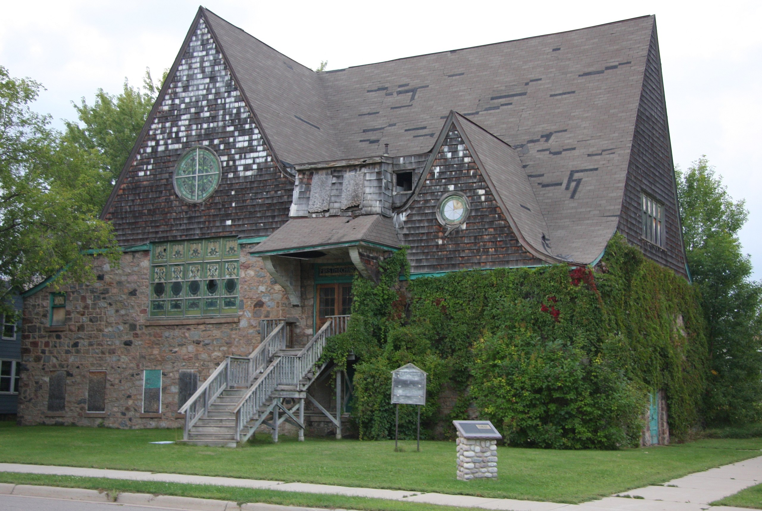
English: Methodist Episcopal Church at N.W. Gayley and Cole Avenues in Coleraine, Minnesota, United States |
| Date | |
| Source | Own work |
| Author | Jonathunder |
|
This is an image of a place or building that is listed on the
National Register of Historic Places in the
United States of America. Its reference number is
82002971. |
| Camera location |
| View this and other nearby images on: OpenStreetMap |
|
|---|
Licensing

|
Permission is granted to copy, distribute and/or modify this document under the terms of the GNU Free Documentation License, Version 1.2 only as published by the Free Software Foundation; with no Invariant Sections, no Front-Cover Texts, and no Back-Cover Texts. A copy of the license is included in the section entitled GNU Free Documentation License. | 1.2 only |
File history
Click on a date/time to view the file as it appeared at that time.
| Date/Time | Thumbnail | Dimensions | User | Comment | |
|---|---|---|---|---|---|
| current | 04:20, 19 September 2015 |
| 3,672 × 2,465 (1.49 MB) | Jonathunder | {{Information |Description ={{en|1=Methodist Episcopal Church at N.W. Gayley and Cole Avenues in Coleraine, Minnesota, United States}} |Source ={{own}} |Author = Jonathunder |Date =2015-08-31 |Permission... |
File usage
The following pages on the English Wikipedia use this file (pages on other projects are not listed):
Global file usage
The following other wikis use this file:
- Usage on de.wikipedia.org
- Usage on fr.wikipedia.org
- Usage on www.wikidata.org