
Size of this preview:
800 × 530 pixels. Other resolutions:
320 × 212 pixels |
640 × 424 pixels |
1,024 × 678 pixels |
1,280 × 848 pixels |
2,560 × 1,696 pixels |
4,928 × 3,264 pixels.
Original file (4,928 × 3,264 pixels, file size: 2.13 MB, MIME type: image/jpeg)
| This is a file from the
Wikimedia Commons. Information from its
description page there is shown below. Commons is a freely licensed media file repository. You can help. |
Summary
| Description |
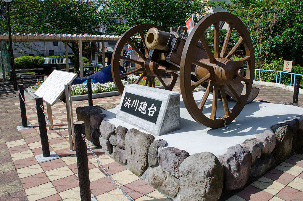
日本語: 東京都品川区東大井 新浜川公園(土佐藩 抱屋敷跡)。ペリー来航への対処として土佐藩が1854年に当地に造った浜川砲台が再現されている。
English: Site of the Hamakawa Gun Battery built by the Tosa Domain Government in 1854 at Shinagawa, Tokyo. |
| Date | |
| Source | Own work |
| Author | Doricono |
| Camera location |
| View this and other nearby images on: OpenStreetMap |
|
|---|
Licensing
I, the copyright holder of this work, hereby publish it under the following license:
This file is licensed under the
Creative Commons
Attribution-Share Alike 4.0 International license.
- You are free:
- to share – to copy, distribute and transmit the work
- to remix – to adapt the work
- Under the following conditions:
- attribution – You must give appropriate credit, provide a link to the license, and indicate if changes were made. You may do so in any reasonable manner, but not in any way that suggests the licensor endorses you or your use.
- share alike – If you remix, transform, or build upon the material, you must distribute your contributions under the same or compatible license as the original.
File history
Click on a date/time to view the file as it appeared at that time.
| Date/Time | Thumbnail | Dimensions | User | Comment | |
|---|---|---|---|---|---|
| current | 14:39, 25 April 2016 |
| 4,928 × 3,264 (2.13 MB) | Doricono | User created page with UploadWizard |
File usage
The following pages on the English Wikipedia use this file (pages on other projects are not listed):
Global file usage
The following other wikis use this file: