
Size of this PNG preview of this SVG file:
648 × 599 pixels. Other resolutions:
260 × 240 pixels |
519 × 480 pixels |
831 × 768 pixels |
1,108 × 1,024 pixels |
2,215 × 2,048 pixels |
716 × 662 pixels.
Original file (SVG file, nominally 716 × 662 pixels, file size: 430 KB)
| This is a file from the
Wikimedia Commons. Information from its
description page there is shown below. Commons is a freely licensed media file repository. You can help. |
Summary
| Description |
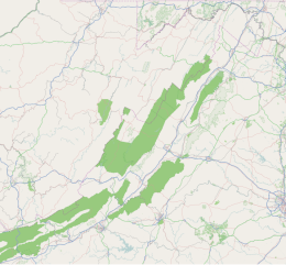
English: Shenandoah Valley where top=39.727009, right=-77.411933, bottom=36.8946632, and left=-81.3492229. |
| Date | |
| Source | http://tiles.wmflabs.org/osm/slippymap2.html |
| Author | Open StreetMap Foundation |
| SVG development |

Licensing
|
|
This work contains information from
OpenStreetMap, which is made available under the
Open Database License (ODbL).
The ODbL does not require any particular license for maps produced from ODbL data. Prior to 1 August 2020, map tiles produced by the OpenStreetMap Foundation were licensed under the CC-BY-SA-2.0 license. Maps produced by other people may be subject to other licences. |
File history
Click on a date/time to view the file as it appeared at that time.
| Date/Time | Thumbnail | Dimensions | User | Comment | |
|---|---|---|---|---|---|
| current | 15:52, 7 May 2017 |
| 716 × 662 (430 KB) | Id4abel | User created page with UploadWizard |
File usage
The following pages on the English Wikipedia use this file (pages on other projects are not listed):
- Alleghany Springs, Virginia
- Balthis House
- Bradshaw, Virginia
- Bridgewater College
- Buena Vista, Virginia
- Camp Rock Enon
- Cave Spring, Virginia
- Childress, Montgomery County, Virginia
- Christendom College
- Clifton Forge, Virginia
- Dixie Caverns
- Dublin, Virginia
- Eastern Mennonite University
- Edward Via College of Osteopathic Medicine
- Eggleston, Virginia
- Ellett, Virginia
- Elliston-Lafayette, Virginia
- Endless Caverns
- Erin (Front Royal, Virginia)
- Fairlawn, Pulaski County, Virginia
- Fairview Farm
- Front Royal, Virginia
- Front Royal Historic District
- Front Royal Recreational Park Historic District
- Frontier Culture Museum
- Goldbond, Virginia
- Grand Caverns
- Graysontown, Virginia
- Hiwassee, Virginia
- Hollins, Virginia
- Ironto, Virginia
- Killahevlin
- Kimballton, Virginia
- Laurel Ridge Community College
- Lexington, Virginia
- Mary Baldwin University
- McCoy, Virginia
- McDonalds Mill, Virginia
- Merrimac, Virginia
- Mountain Home (Front Royal, Virginia)
- Museum of the Shenandoah Valley
- Narrows, Virginia
- Natural Bridge (Virginia)
- New Market, Virginia
- New River, Virginia
- Newport, Giles County, Virginia
- Pearisburg, Virginia
- Pembroke, Virginia
- Pilot, Virginia
- Prices Fork, Virginia
- Pulaski, Virginia
- Radford, Virginia
- Riner, Virginia
- Ripplemead, Virginia
- Riverside (Front Royal, Virginia)
- Riverton Historic District (Front Royal, Virginia)
- Rogers, Virginia
- Rose Hill (Front Royal, Virginia)
- Salem, Virginia
- Shawsville, Virginia
- Shenandoah Caverns
- Shenandoah University
- Skyline Caverns
- Sonner Hall
- Staffordsville, Virginia
- Staunton, Virginia
- Sugar Grove, Montgomery County, Virginia
- The Caverns at Natural Bridge
- Vicker, Virginia
- Virginia Military Institute
- Warren County Courthouse (Virginia)
- Washington and Lee University
- Winchester, Virginia
- Module:Location map/data/Shenandoah Valley
- Module:Location map/data/Shenandoah Valley/doc
Global file usage
The following other wikis use this file:
- Usage on azb.wikipedia.org
- الیستون-لافایت، ویرجینیا
- مریماک، ویرجینیا
- بردشا، ویرجینیا
- کیو اسپرینق، ویرجینیا
- شاوزویل، ویرجینیا
- هالینز، ویرجینیا
- پرایس فورک، ویرجینیا
- راینر، ویرجینیا
- راجرز، ویرجینیا
- نیوریور، ویرجینیا
- هیاوسی، ویرجینیا
- کووینقتون، ویرجینیا
- رادفورد، ویرجینیا
- قریسونتوون، ویرجینیا
- ویکر، ویرجینیا
- روانوک، ویرجینیا
- هریسونبورق، ویرجینیا
- سئیلم، ویرجینیا
- ایستاونتون، ویرجینیا
- Usage on ml.wikipedia.org
- Usage on simple.wikipedia.org
- Usage on si.wikipedia.org
- Usage on te.wikipedia.org
- Usage on tl.wikipedia.org
- Usage on ur.wikipedia.org