
Size of this preview:
800 × 600 pixels. Other resolutions:
320 × 240 pixels |
640 × 480 pixels |
1,024 × 768 pixels |
1,280 × 960 pixels |
2,560 × 1,920 pixels |
3,264 × 2,448 pixels.
Original file (3,264 × 2,448 pixels, file size: 3.19 MB, MIME type: image/jpeg)
| This is a file from the
Wikimedia Commons. Information from its
description page there is shown below. Commons is a freely licensed media file repository. You can help. |
| Description |
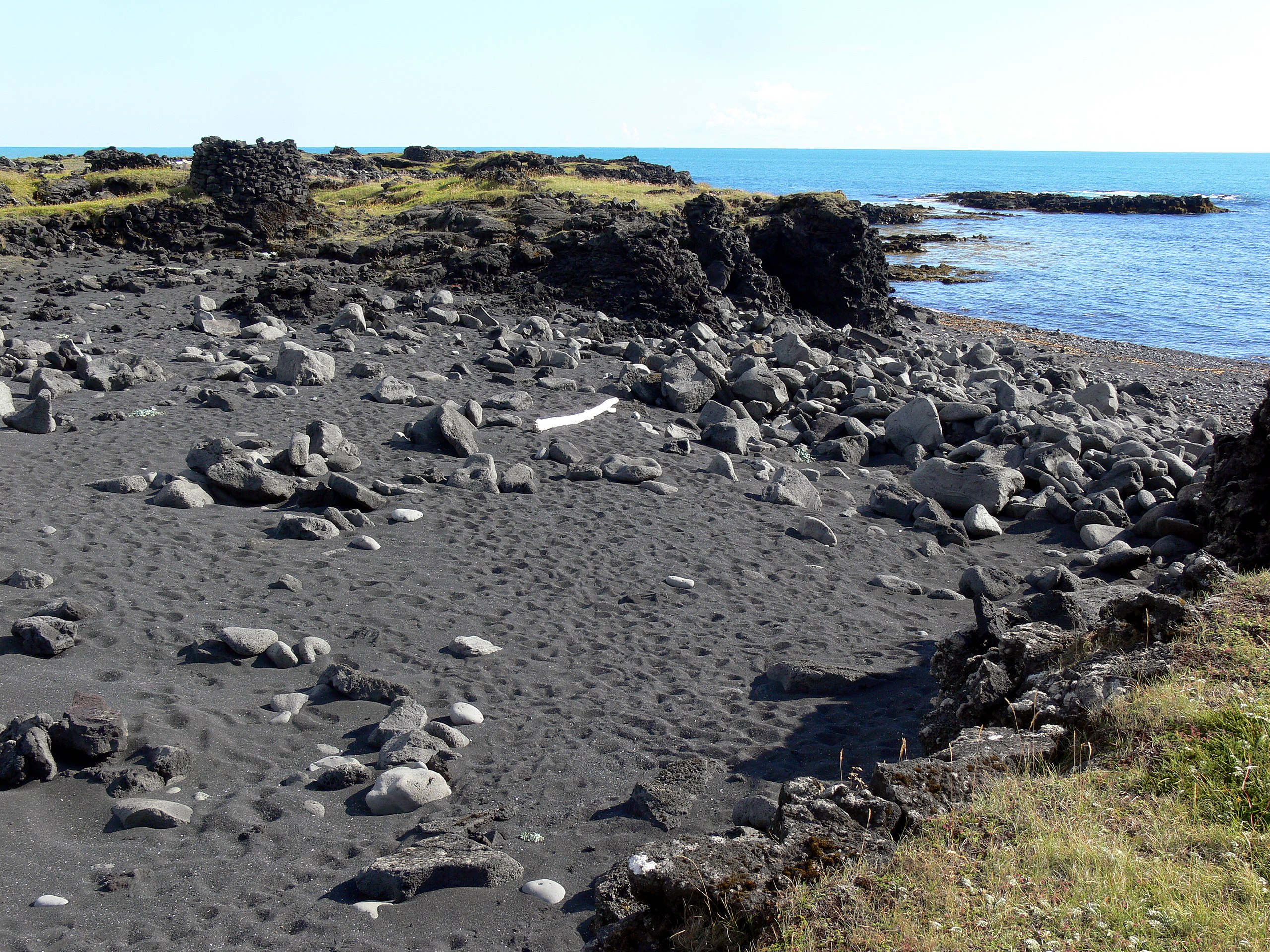
Deutsch: Selatangar auf Reykjanes. |
| Date | 12 August 2008, 18:11:59 (according to Exif data) |
| Source | Own work |
| Author | Christian Bickel |
This file is licensed under the
Creative Commons
Attribution-Share Alike 2.0 Germany license.
- You are free:
- to share – to copy, distribute and transmit the work
- to remix – to adapt the work
- Under the following conditions:
- attribution – You must give appropriate credit, provide a link to the license, and indicate if changes were made. You may do so in any reasonable manner, but not in any way that suggests the licensor endorses you or your use.
- share alike – If you remix, transform, or build upon the material, you must distribute your contributions under the same or compatible license as the original.

| Camera location |
| View this and other nearby images on: OpenStreetMap |
|
|---|
File history
Click on a date/time to view the file as it appeared at that time.
| Date/Time | Thumbnail | Dimensions | User | Comment | |
|---|---|---|---|---|---|
| current | 15:05, 1 September 2008 |
| 3,264 × 2,448 (3.19 MB) | Fingalo | {{Information |Description={{de|1=Selatangar auf Reykjanes, eine alte Fischereistation, die vom Mittelalter bis 1884 in Betrieb war. Die Bauern fuhren von hier in offenen Booten hinaus zum Fischfang. Erhalten sind kleine ummauerte Aufbewahrungsorte für d |
File usage
The following pages on the English Wikipedia use this file (pages on other projects are not listed):
Global file usage
The following other wikis use this file:
- Usage on el.wikipedia.org
- Usage on eu.wikipedia.org
- Usage on fa.wikipedia.org
- Usage on fr.wikipedia.org
- Usage on ka.wikipedia.org
- Usage on nl.wikipedia.org
- Usage on xmf.wikipedia.org