
Original file (2,543 × 1,775 pixels, file size: 7.01 MB, MIME type: image/png)
| This is a file from the
Wikimedia Commons. Information from its
description page there is shown below. Commons is a freely licensed media file repository. You can help. |
Summary
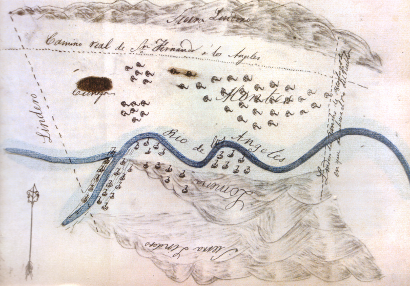
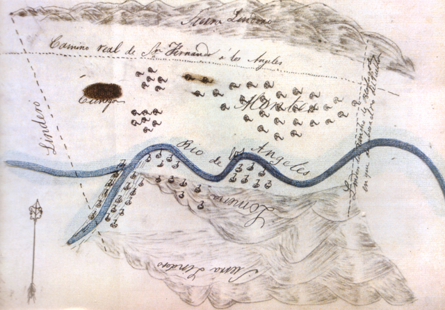
| Description | Sketch map or diseño of the Scott Tract of Rancho San Rafael (eastern Burbank, California). |
| Date | between 1857 and 1871 |
| Source | Scanned from Derek Hayes, Historical Atlas of California, University of California Press 2007, ISBN 9780520252585 |
| Author | Unknown author |
Licensing
|
This work is in the public domain in its country of origin and other countries and areas where the copyright term is the author's life plus 70 years or fewer.
| |
| This file has been identified as being free of known restrictions under copyright law, including all related and neighboring rights. | |
File history
Click on a date/time to view the file as it appeared at that time.
| Date/Time | Thumbnail | Dimensions | User | Comment | |
|---|---|---|---|---|---|
| current | 18:50, 18 April 2009 |
| 2,543 × 1,775 (7.01 MB) | PKM | {{Information |Description=Sketch map or ''diseño'' of Rancho Providencia, now part of Burbank, California. |Source=Scanned from Derek Hayes, ''Historical Atlas of California'', University of California Press 2007, ISBN 9780520252585 |Date=1840s |Author= |
File usage
Global file usage
The following other wikis use this file:
- Usage on es.wikipedia.org
- Usage on fr.wikipedia.org