Size of this preview:
331 × 598 pixels. Other resolutions:
133 × 240 pixels |
265 × 480 pixels |
860 × 1,555 pixels.
Original file (860 × 1,555 pixels, file size: 45 KB, MIME type: image/png)
| This is a file from the
Wikimedia Commons. Information from its
description page there is shown below. Commons is a freely licensed media file repository. You can help. |
Summary
| Description |
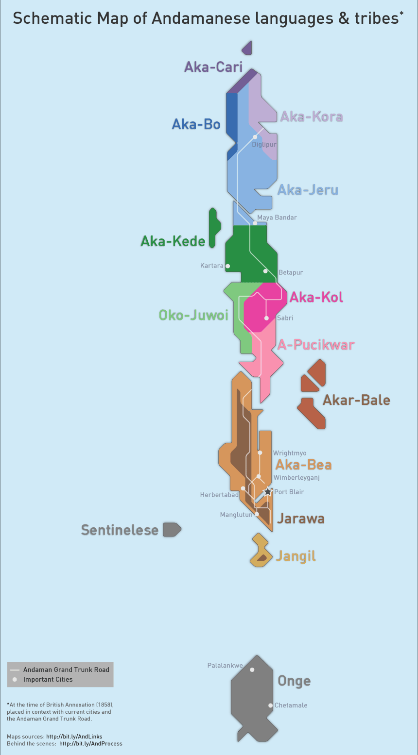
English: Schematic Map based from the time of British Annexation (1851), along with current cities and the Andaman GT Road. |
| Date | |
| Source | Own work. Created in Illustrator, based on this map by Ko'oy. |
| Author | Rasagy Sharma |
Licensing
I, the copyright holder of this work, hereby publish it under the following license:
This file is licensed under the
Creative Commons
Attribution-Share Alike 3.0 Unported license.
- You are free:
- to share – to copy, distribute and transmit the work
- to remix – to adapt the work
- Under the following conditions:
- attribution – You must give appropriate credit, provide a link to the license, and indicate if changes were made. You may do so in any reasonable manner, but not in any way that suggests the licensor endorses you or your use.
- share alike – If you remix, transform, or build upon the material, you must distribute your contributions under the same or compatible license as the original.
File history
Click on a date/time to view the file as it appeared at that time.
| Date/Time | Thumbnail | Dimensions | User | Comment | |
|---|---|---|---|---|---|
| current | 11:28, 10 August 2013 |
| 860 × 1,555 (45 KB) | Rasagy | User created page with UploadWizard |
File usage
The following pages on the English Wikipedia use this file (pages on other projects are not listed):
- A-Pucikwar language
- Aka-Bea language
- Aka-Bo language
- Aka-Cari language
- Aka-Jeru language
- Aka-Kede language
- Aka-Kol language
- Aka-Kora language
- Akar-Bale language
- Bo people (Andaman)
- Cari people
- Great Andamanese
- Great Andamanese languages
- Jarawa language (Andaman Islands)
- Kora people
- Oko-Juwoi language
- Onge language
- Sentinelese language
- User:Benipal hardarshan/FNF-pa
- User:Benipal hardarshan/FNF-ta
Global file usage
The following other wikis use this file:
- Usage on af.wikipedia.org
- Usage on bn.wikipedia.org
- Usage on ca.wikipedia.org
- Usage on cs.wikipedia.org
- Usage on es.wikipedia.org
- Usage on eu.wikipedia.org
- Usage on fa.wikipedia.org
- Usage on fi.wikipedia.org
- Usage on fr.wikipedia.org
- Usage on gl.wikipedia.org
- Usage on id.wikipedia.org
- Usage on ja.wikipedia.org
- Usage on ko.wikipedia.org
- Usage on mr.wikipedia.org
- Usage on pa.wikipedia.org
- Usage on pnb.wikipedia.org
- Usage on pt.wikipedia.org
- Usage on ru.wikipedia.org
- Usage on sat.wikipedia.org
- Usage on ta.wikipedia.org
- Usage on th.wikipedia.org
- Usage on tr.wikipedia.org
- Usage on uk.wikipedia.org
- Usage on ur.wikipedia.org
View more global usage of this file.