
Size of this preview:
800 × 600 pixels. Other resolutions:
320 × 240 pixels |
640 × 480 pixels |
1,024 × 768 pixels |
1,280 × 960 pixels |
2,560 × 1,920 pixels |
4,032 × 3,024 pixels.
Original file (4,032 × 3,024 pixels, file size: 1.43 MB, MIME type: image/jpeg)
| This is a file from the
Wikimedia Commons. Information from its
description page there is shown below. Commons is a freely licensed media file repository. You can help. |
Summary
| Description |
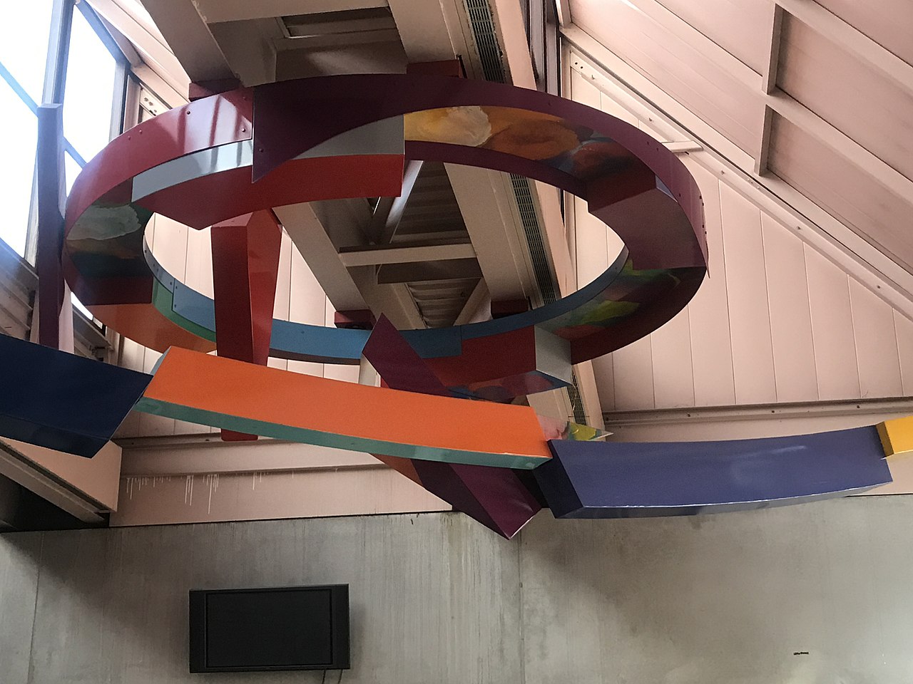
English: Close up of Solar Canopy |
| Date | |
| Source | York College, City University of New York |
| Author | Sam Giliam |
| Camera location | | View this and other nearby images on: OpenStreetMap |
|
|---|
Licensing
- Object
-
 This work is in the public domain because it was published in the United States between 1978 and March 1, 1989 without a copyright notice, and its copyright was not subsequently registered with the U.S. Copyright Office within 5 years. Unless its author has been dead for several years, it is copyrighted in the countries or areas that do not apply the rule of the shorter term for US works, such as Canada (50 pma), Mainland China (50 pma, not Hong Kong or Macau), Germany (70 pma), Mexico (100 pma), Switzerland (70 pma), and other countries with individual treaties. See this page for further explanation.

- Photograph


 This file is licensed under the Creative Commons Attribution-Share Alike 4.0 International license.Attribution: Melicolin23
- You are free:
- to share – to copy, distribute and transmit the work
- to remix – to adapt the work
- Under the following conditions:
- attribution – You must give appropriate credit, provide a link to the license, and indicate if changes were made. You may do so in any reasonable manner, but not in any way that suggests the licensor endorses you or your use.
- share alike – If you remix, transform, or build upon the material, you must distribute your contributions under the same or compatible license as the original.
- You are free:
File history
Click on a date/time to view the file as it appeared at that time.
| Date/Time | Thumbnail | Dimensions | User | Comment | |
|---|---|---|---|---|---|
| current | 00:04, 1 December 2017 |
| 4,032 × 3,024 (1.43 MB) | Melicolin23 | User created page with UploadWizard |
File usage
The following pages on the English Wikipedia use this file (pages on other projects are not listed):