Size of this preview:
800 × 457 pixels. Other resolutions:
320 × 183 pixels |
640 × 366 pixels |
1,024 × 585 pixels |
1,400 × 800 pixels.
Original file (1,400 × 800 pixels, file size: 302 KB, MIME type: image/jpeg)
| This is a file from the
Wikimedia Commons. Information from its
description page there is shown below. Commons is a freely licensed media file repository. You can help. |
Summary
| Description |
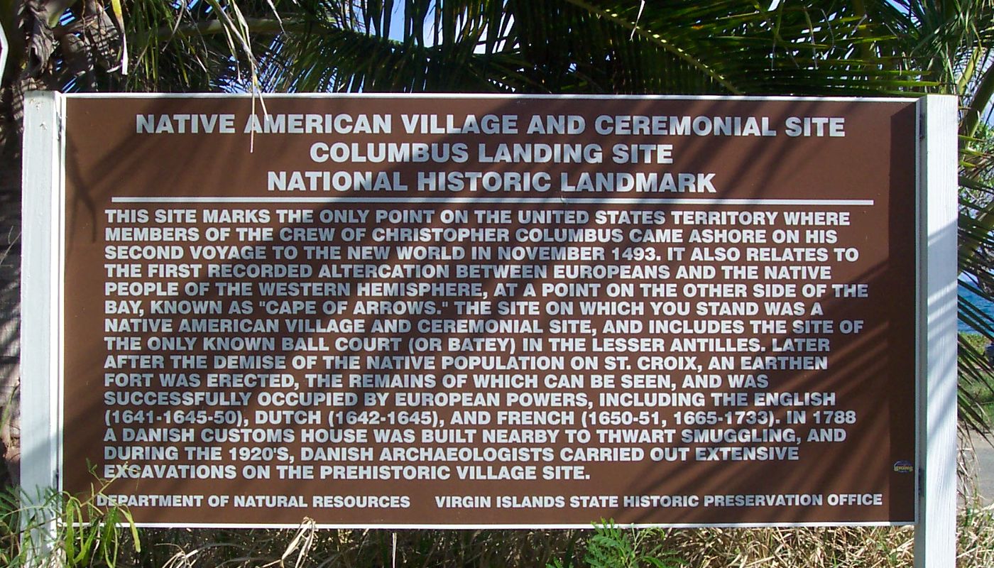
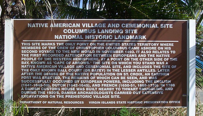
Historical marker/information sign at Salt River Bay National Historical Park and Ecological Preserve. 17°46′44″N 64°45′33″W / 17.77889°N 64.75917°W Transcription:
|
| Date | |
| Source | Own work |
| Author | self |
| Permission ( Reusing this file) |
public domain |
Licensing
| I, the copyright holder of this work, release this work into the
public domain. This applies worldwide. In some countries this may not be legally possible; if so: I grant anyone the right to use this work for any purpose, without any conditions, unless such conditions are required by law. |
File history
Click on a date/time to view the file as it appeared at that time.
| Date/Time | Thumbnail | Dimensions | User | Comment | |
|---|---|---|---|---|---|
| current | 18:26, 7 March 2007 |
| 1,400 × 800 (302 KB) | Eoghanacht | {{Information |Description= Historical marker/information sign at {{w|Salt River Bay National Historical Park and Ecological Preserve}}. {{coor dms|17|46|44|N|64|45|33|W|}} |Source= own work |Date= 2007 February |Author= self |Permission= public domain | |
File usage
The following pages on the English Wikipedia use this file (pages on other projects are not listed):
Global file usage
The following other wikis use this file:
- Usage on it.wikipedia.org
- Usage on sr.wikipedia.org
- Usage on vi.wikipedia.org