
Size of this preview:
800 × 584 pixels. Other resolutions:
320 × 234 pixels |
640 × 467 pixels |
1,024 × 748 pixels |
1,280 × 935 pixels |
2,560 × 1,870 pixels |
5,258 × 3,840 pixels.
Original file (5,258 × 3,840 pixels, file size: 17.35 MB, MIME type: image/jpeg)
| This is a file from the
Wikimedia Commons. Information from its
description page there is shown below. Commons is a freely licensed media file repository. You can help. |
Summary
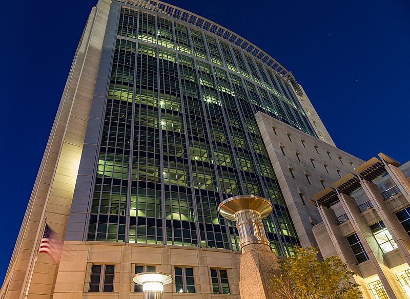
| Description | Robert T. Matsui United States Courthouse, Eastern District of California |
| Date | |
| Source | Sacramento Federal Court Building - Robert T. Matsui United States Courthouse |
| Author | Tony Webster from Minneapolis, Minnesota, United States |
| Other versions |
.jpg)
_(cropped).jpg)
| Camera location |
| View this and other nearby images on: OpenStreetMap |
|
|---|
_(cropped).jpg¶ms=038.583358_N_-121.499528_E_globe:Earth_type:camera_source:Flickr_&language=en)
Licensing
This file is licensed under the
Creative Commons
Attribution 2.0 Generic license.
- You are free:
- to share – to copy, distribute and transmit the work
- to remix – to adapt the work
- Under the following conditions:
- attribution – You must give appropriate credit, provide a link to the license, and indicate if changes were made. You may do so in any reasonable manner, but not in any way that suggests the licensor endorses you or your use.
File history
Click on a date/time to view the file as it appeared at that time.
| Date/Time | Thumbnail | Dimensions | User | Comment | |
|---|---|---|---|---|---|
| current | 19:51, 1 September 2022 |
| 5,258 × 3,840 (17.35 MB) | Cristiano Tomás | File:Sacramento Federal Court Building - Robert T. Matsui United States Courthouse (25379475283).jpg cropped 9 % horizontally using CropTool with precise mode. |
.jpg)
File usage
The following pages on the English Wikipedia use this file (pages on other projects are not listed):
_(cropped).jpg)