
Size of this preview:
494 × 599 pixels. Other resolutions:
198 × 240 pixels |
396 × 480 pixels |
653 × 792 pixels.
Original file (653 × 792 pixels, file size: 105 KB, MIME type: image/jpeg)
| This is a file from the
Wikimedia Commons. Information from its
description page there is shown below. Commons is a freely licensed media file repository. You can help. |
Summary
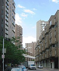
Main Street on Roosevelt Island
Taken on September 1, 2005
Uploaded by "paytonc" to Flickr [1]
| Camera location | | View this and other nearby images on: OpenStreetMap |
|
|---|
Licensing
This file is licensed under the
Creative Commons
Attribution 2.0 Generic license.
- You are free:
- to share – to copy, distribute and transmit the work
- to remix – to adapt the work
- Under the following conditions:
- attribution – You must give appropriate credit, provide a link to the license, and indicate if changes were made. You may do so in any reasonable manner, but not in any way that suggests the licensor endorses you or your use.
| This image was originally posted to Flickr by paytonc at https://www.flickr.com/photos/paytonc/39423295/. It was reviewed on 5 January 2007 by FlickreviewR and was confirmed to be licensed under the terms of the cc-by-2.0. |
File history
Click on a date/time to view the file as it appeared at that time.
| Date/Time | Thumbnail | Dimensions | User | Comment | |
|---|---|---|---|---|---|
| current | 04:24, 22 May 2012 |
| 653 × 792 (105 KB) | Beyond My Ken | adjustments for visibility |
| 09:11, 31 December 2005 |
 | 653 × 792 (100 KB) | Pharos | Main Street on Roosevelt Island Taken on September 1, 2005 Uploaded by "paytonc" to Flickr[http://www.flickr.com/photos/paytonc/39423295/] |
File usage
The following pages on the English Wikipedia use this file (pages on other projects are not listed):
Global file usage
The following other wikis use this file:
- Usage on ca.wikipedia.org
- Usage on cs.wikipedia.org
- Usage on da.wikipedia.org
- Usage on fr.wikipedia.org
- Usage on hy.wikipedia.org
- Usage on id.wikipedia.org
- Usage on it.wikipedia.org
- Usage on ja.wikipedia.org
- Usage on ko.wikipedia.org
- Usage on la.wikipedia.org
- Usage on nl.wikipedia.org
- Usage on pl.wikipedia.org
- Usage on ru.wikipedia.org
- Usage on simple.wikipedia.org
- Usage on sk.wikipedia.org
- Usage on uk.wikipedia.org
- Usage on zh.wikipedia.org