
Size of this PNG preview of this SVG file:
799 × 560 pixels. Other resolutions:
320 × 224 pixels |
640 × 449 pixels |
1,024 × 718 pixels |
1,280 × 897 pixels |
2,560 × 1,794 pixels.
Original file (SVG file, nominally 799 × 560 pixels, file size: 115 KB)
| This is a file from the
Wikimedia Commons. Information from its
description page there is shown below. Commons is a freely licensed media file repository. You can help. |
Summary
| Description |
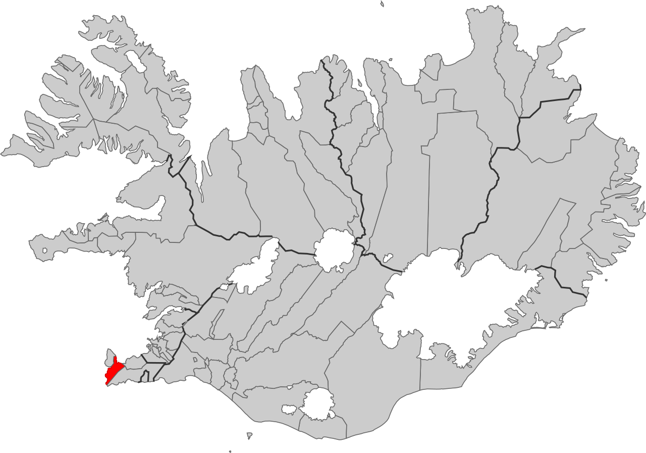
English: Locator map of the municipality of Reykjanesbær in Iceland.
Íslenska: Kort yfir sveitarfélagið Reykjanesbæ á Íslandi. |
| Date | |
| Source | File:Suðurnesjabær.svg |
| Author | User:Maxí, edited by User:TFerenczy |
Licensing
This file is licensed under the
Creative Commons
Attribution-Share Alike 4.0 International license.
- You are free:
- to share – to copy, distribute and transmit the work
- to remix – to adapt the work
- Under the following conditions:
- attribution – You must give appropriate credit, provide a link to the license, and indicate if changes were made. You may do so in any reasonable manner, but not in any way that suggests the licensor endorses you or your use.
- share alike – If you remix, transform, or build upon the material, you must distribute your contributions under the same or compatible license as the original.
File history
Click on a date/time to view the file as it appeared at that time.
| Date/Time | Thumbnail | Dimensions | User | Comment | |
|---|---|---|---|---|---|
| current | 18:23, 26 June 2019 |
| 799 × 560 (115 KB) | TFerenczy | User created page with UploadWizard |
File usage
No pages on the English Wikipedia use this file (pages on other projects are not listed).
Global file usage
The following other wikis use this file:
- Usage on ru.wikipedia.org