
Size of this preview:
763 × 600 pixels. Other resolutions:
306 × 240 pixels |
611 × 480 pixels |
978 × 768 pixels |
1,280 × 1,006 pixels |
2,560 × 2,011 pixels |
5,600 × 4,400 pixels.
Original file (5,600 × 4,400 pixels, file size: 2.97 MB, MIME type: image/jpeg)
| This is a file from the
Wikimedia Commons. Information from its
description page there is shown below. Commons is a freely licensed media file repository. You can help. |
Summary
| Description |
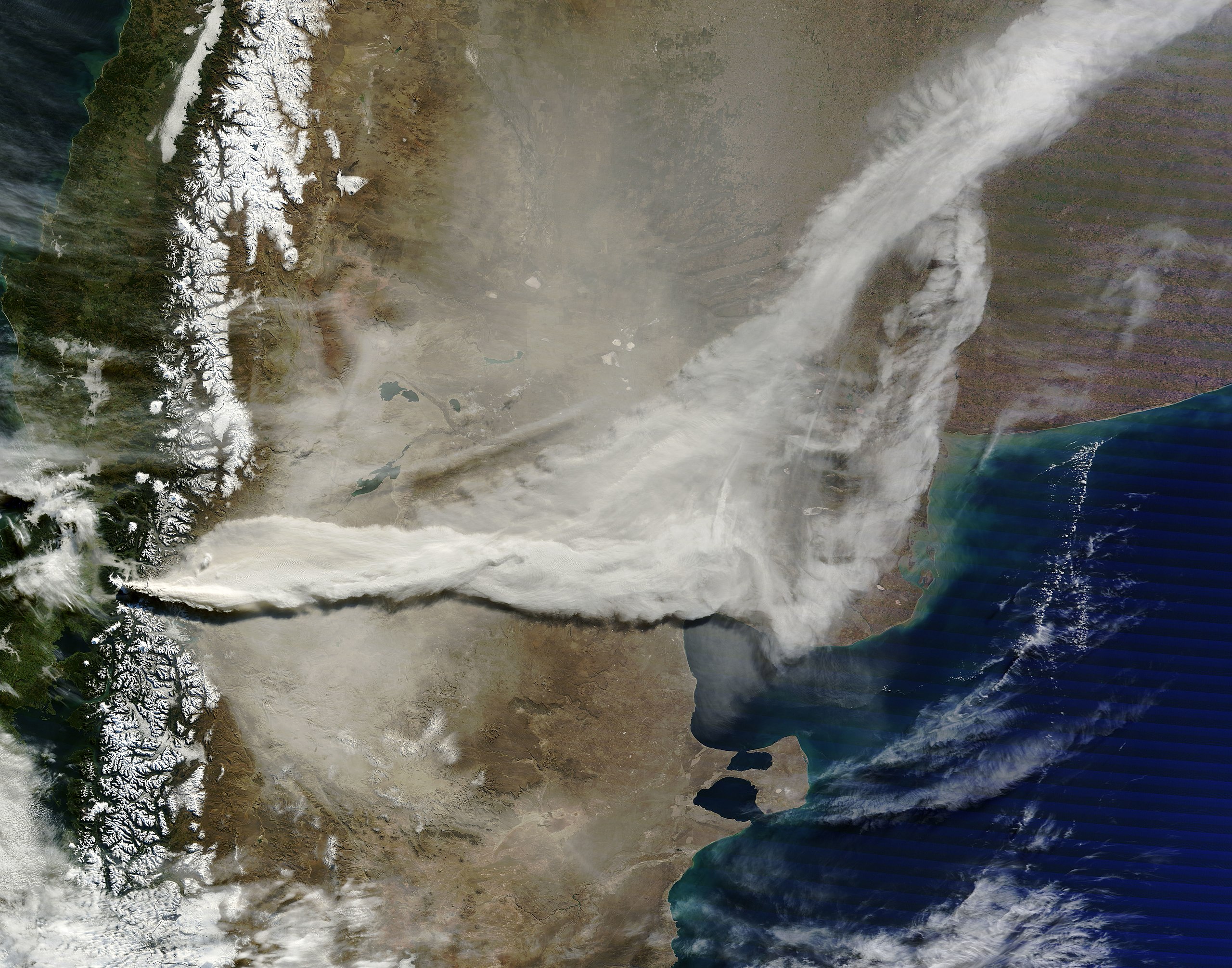
English: Image showing ash on the ground and a large plume streaming east from the erupting Puyehue-Cordón Volcano Complex in Chile. The image above also shows a large plume of volcanic ash blowing about 800 kilometers east and then northeast over
Argentina. |
| Date | |
| Source | NASA Earth Observatory |
| Author | Jeff Schmaltz |
| Camera location |
| View this and other nearby images on: OpenStreetMap |
|
|---|
Image captured by the Moderate Resolution Imaging Spectroradiometer (MODIS) on the Terra satellite.
Licensing
| This file is in the public domain in the United States because it was solely created by NASA. NASA copyright policy states that "NASA material is not protected by copyright unless noted". (See Template:PD-USGov, NASA copyright policy page or JPL Image Use Policy.) | ||
 |
Warnings:
|
| Annotations | This image is annotated: View the annotations at Commons |
File history
Click on a date/time to view the file as it appeared at that time.
| Date/Time | Thumbnail | Dimensions | User | Comment | |
|---|---|---|---|---|---|
| current | 11:19, 15 June 2011 |
| 5,600 × 4,400 (2.97 MB) | Originalwana | {{Information |Description ={{en|1=Image showing ash on the ground and a large plume streaming east from the erupting Puyehue-Cordón Volcano Complex in Chile. The image above also shows a large plume of volcanic ash blowing about 800 kilometers east a |
File usage
The following pages on the English Wikipedia use this file (pages on other projects are not listed):
Global file usage
The following other wikis use this file:
- Usage on fi.wikipedia.org
- Usage on nl.wikipedia.org