No higher resolution available.
Position_of_Auckland_Region.png (405 × 590 pixels, file size: 7 KB, MIME type: image/png)
| This is a file from the
Wikimedia Commons. Information from its
description page there is shown below. Commons is a freely licensed media file repository. You can help. |
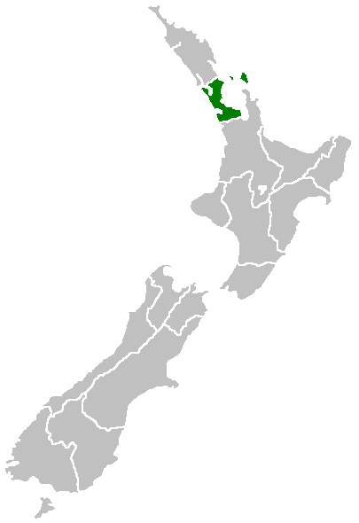
Region of New Zealand, position on the map (source:English Wiki)
| |
This work has been released into the
public domain by its author,
Furius, at the
English Wikipedia project. This applies worldwide. In case this is not legally possible: |
File history
Click on a date/time to view the file as it appeared at that time.
| Date/Time | Thumbnail | Dimensions | User | Comment | |
|---|---|---|---|---|---|
| current | 07:40, 27 April 2005 |
| 405 × 590 (7 KB) | Domie~commonswiki | Region of New Zealand, position on the map (source:English Wiki) {{PD}} Category:Maps of New Zealand |
File usage
The following pages on the English Wikipedia use this file (pages on other projects are not listed):
- Ahuroa
- Aiguilles Island
- Airport Oaks
- Albany Lakes Civic Park
- Anawhata
- Anvil Islet
- Archway Island (Kawau Island)
- Ark in the Park (conservation project)
- Ash Hill, New Zealand
- Atihau Island
- Beehive Island / Taungamaro Island
- Big Ōmaha
- Bike Auckland
- Blackpool, New Zealand
- Boggust Park Crater
- Brazier Rock
- Broken Islands / Pig Islands
- Burgess Island / Pokohinu
- Cemetery Crater
- Chapel Downs
- Churchill Park, New Zealand
- Colville Channel
- Cosseys Reservoir
- Cradock Channel
- Crater Hill
- Dragon Island
- Duders Hill
- Franklin County, New Zealand
- Hampton Park, New Zealand
- Highbrook
- Horuhoru Rock (Gannet Rock)
- Hūnua Falls
- Jellicoe Channel
- Keri Hill
- Kohuora
- Lake Keretā
- Lake Kuwakatai
- Lake Rototoa
- Little Rangitoto
- Long Bay-Okura Marine Reserve
- Long Bay Regional Park
- Lower Nihotupu Reservoir
- Lucas Heights, New Zealand
- Mahurangi Peninsula
- Mahurangi Regional Park
- Mathesons Bay
- Matiatia
- Matukutūruru
- McLennan Hills
- Milldale, New Zealand
- Mokoroa Falls
- Motairehe
- Motuora
- Moturekareka Island
- Mount Cambria
- Mount Hobson (Great Barrier Island)
- Mount Saint John (New Zealand)
- Ngarango Otainui Island
- Onepoto (volcanic crater)
- Orere Point Regional Park
- Pakatoa Island
- Papakura City
- Papakura Military Camp
- Ponui Island
- Pukaki Lagoon
- Pukeiti (Auckland)
- Pukekohe East Explosion Crater
- Pukewairiki
- Purchas Hill
- Pākiri Regional Park
- Pōhutukawa Bay
- Redvale, New Zealand
- Robertson Hill
- Rodney County, New Zealand
- Shepherds Park
- Southdown, New Zealand
- Southern Path
- St Johns Bush
- Stockade Hill
- Styaks Swamp
- Tamaki City
- Tarahiki Island
- Tawhitokino Regional Park
- Te Pou Hawaiki
- Te Rau Pūriri Regional Park
- Te Ārai
- Tomarata
- Traherne Island
- Tāpapakanga Regional Park
- Umupuia Beach
- Upper Nihotupu Reservoir
- Waitawa Regional Park
- Waitemata City
- Watchman Island
- Windy Canyon
- Woodcocks, New Zealand
- Ōhinerau / Mount Hobson
- Ōtara Hill
- Ōtāhuhu / Mount Richmond
- Template:Auckland-geo-stub
Global file usage
The following other wikis use this file:
- Usage on ceb.wikipedia.org
- Usage on eu.wikipedia.org
- Usage on fa.wikipedia.org
- Usage on fy.wikipedia.org
- Usage on hi.wikipedia.org
- Usage on hr.wikipedia.org
- Usage on id.wikipedia.org
- Usage on ja.wikipedia.org
- Usage on ko.wikipedia.org
- Usage on mi.wikipedia.org
- Tāmaki-makau-rau
- Onehunga
- Whangaparāoa (Tāmaki-makau-rau)
- Template:Maramara matawhenua (Tāmaki-makau-rau)
- Streamlands
- Kaipara Flats
- Mangakura
- Kourawhero
- Algies Bay
- Hepburn Creek
- Woodcocks
- Pohuehue
- Glorit
- South Head
- Mahurangi
- Pukapuka
- Ahuroa
- Komokoriki
- Mahurangi West
- Puhoi
- Araparera
- Tahekeroa
- Kakanui
- Waiwera
- Mairetahi
- Waioneke
- Makarau
- Hatfields Beach
- Shelly Beach
- Kanohi
- Army Bay
- Red Beach
- Kaukapakapa
- Matakatia Bay
- Tindalls Beach
- Stanmore Bay
- Silverdale
- Big Manly
- Little Manly
- Pine Valley
View more global usage of this file.