
Size of this PNG preview of this SVG file:
511 × 600 pixels. Other resolutions:
204 × 240 pixels |
409 × 480 pixels |
654 × 768 pixels |
873 × 1,024 pixels |
1,745 × 2,048 pixels |
600 × 704 pixels.
Original file (SVG file, nominally 600 × 704 pixels, file size: 647 KB)
| This is a file from the
Wikimedia Commons. Information from its
description page there is shown below. Commons is a freely licensed media file repository. You can help. |
| Description |
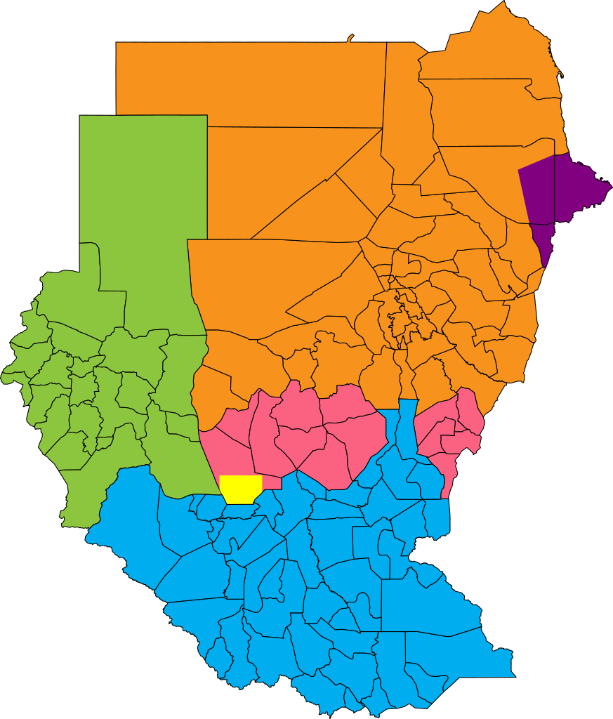
English: Map showing political regions of Sudan as of July 2006.
Darfur
Nuba Mountains and Blue Nile
North Sudan
South Sudan
Eastern Front, area of operations July 2006
Abyei, as defined by the Permanent Court of Arbitration |
| Date | |
| Source |
|
| Author | Lokal_Profil |
| Permission ( Reusing this file) |
This file is licensed under the
Creative Commons
Attribution-Share Alike 2.5 Generic license. Attribution:
Lokal_Profil
|
.png)
File history
Click on a date/time to view the file as it appeared at that time.
| Date/Time | Thumbnail | Dimensions | User | Comment | |
|---|---|---|---|---|---|
| current | 09:38, 22 January 2011 |
| 600 × 704 (647 KB) | Wiz9999 | Updated borders of Southern Kordofan/Nuba Mountains State as according to http://www.occasionalwitness.com/Articles/20040526b.htm and File:Sudan location map.svg |
| 06:42, 26 July 2009 |
 | 600 × 704 (640 KB) | Wiz9999 | The Permanent Court of Arbitration has defined new boundaries for Abyei, which both parties have accepted. Official map: [http://www.pca-cpa.org/upload/files/Abyei%20Award%20Appendix%202.pdf] | |
| 19:24, 26 May 2008 |
 | 600 × 704 (633 KB) | Lokal Profil | Last two features | |
| 18:57, 26 May 2008 |
 | 600 × 704 (581 KB) | Lokal Profil | {{Information |Description={{en|Map showing political regions of Sudan as of July 2006.}} {{legend|#8cc63f|Darfur}} {{legend|#fb6282|Nuba Mountains and Blue Nile}} {{legend|#f7931d|North Sudan}} {{legend|#00adef|South Sudan}} |Source=*Vector map from [[:I |
File usage
The following pages on the English Wikipedia use this file (pages on other projects are not listed):
Global file usage
The following other wikis use this file:
- Usage on af.wikipedia.org
- Usage on ar.wikipedia.org
- Usage on arz.wikipedia.org
- Usage on ast.wikipedia.org
- Usage on ba.wikipedia.org
- Usage on bn.wikipedia.org
- Usage on bs.wikipedia.org
- Usage on ca.wikipedia.org
- Usage on cs.wikipedia.org
- Usage on da.wikipedia.org
- Usage on de.wikipedia.org
- Usage on din.wikipedia.org
- Usage on el.wikipedia.org
- Usage on es.wikipedia.org
- Usage on et.wikipedia.org
- Usage on fa.wikipedia.org
- Usage on fi.wikipedia.org
- Usage on fr.wikipedia.org
- Usage on he.wikipedia.org
- Usage on hu.wikipedia.org
- Usage on hy.wikipedia.org
- Usage on id.wikipedia.org
- Usage on it.wikipedia.org
- Usage on ja.wikipedia.org
- Usage on ka.wikipedia.org
- Usage on lt.wikipedia.org
- Usage on nn.wikipedia.org
- Usage on no.wikipedia.org
- Usage on pl.wikipedia.org
- Usage on pl.wikinews.org
- Usage on pnb.wikipedia.org
- Usage on pt.wikipedia.org
View more global usage of this file.