
Size of this preview:
450 × 600 pixels. Other resolutions:
180 × 240 pixels |
360 × 480 pixels |
576 × 768 pixels |
768 × 1,024 pixels |
1,680 × 2,240 pixels.
Original file (1,680 × 2,240 pixels, file size: 767 KB, MIME type: image/jpeg)
| This is a file from the
Wikimedia Commons. Information from its
description page there is shown below. Commons is a freely licensed media file repository. You can help. |
Summary
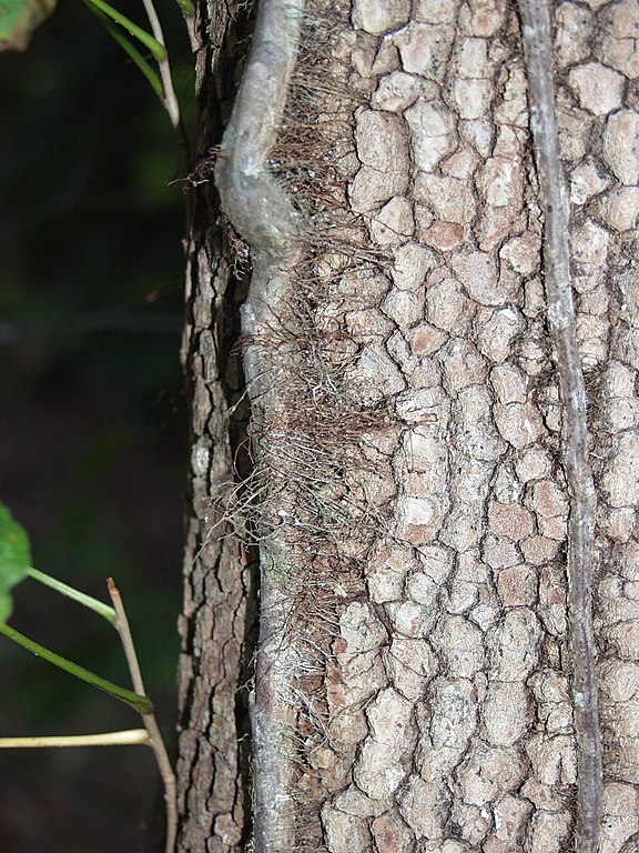
| Description | Poison-ivy vine located in Mount Airy, NC |
| Date | |
| Source | Own work |
| Author | Melissa MB Wilkins |
| Camera location |
| View this and other nearby images on: OpenStreetMap |
|
|---|
Licensing
I,
Melissambwilkins, the copyright holder of this work, hereby publishes it under the following licenses:

|
Permission is granted to copy, distribute and/or modify this document under the terms of the GNU Free Documentation License, Version 1.2 or any later version published by the Free Software Foundation; with no Invariant Sections, no Front-Cover Texts, and no Back-Cover Texts. A copy of the license is included in the section entitled GNU Free Documentation License. |
| This file is licensed under the Creative Commons Attribution-Share Alike 3.0 Unported license. | ||
| Attribution: I, Melissambwilkins | ||
| ||
| This licensing tag was added to this file as part of the GFDL licensing update. |
This file is licensed under the
Creative Commons Attribution-Share Alike
2.5 Generic,
2.0 Generic and
1.0 Generic license.
Attribution: I,
Melissambwilkins
- You are free:
- to share – to copy, distribute and transmit the work
- to remix – to adapt the work
- Under the following conditions:
- attribution – You must give appropriate credit, provide a link to the license, and indicate if changes were made. You may do so in any reasonable manner, but not in any way that suggests the licensor endorses you or your use.
- share alike – If you remix, transform, or build upon the material, you must distribute your contributions under the same or compatible license as the original.
You may select the license of your choice.
File history
Click on a date/time to view the file as it appeared at that time.
| Date/Time | Thumbnail | Dimensions | User | Comment | |
|---|---|---|---|---|---|
| current | 18:16, 29 July 2007 |
| 1,680 × 2,240 (767 KB) | Melissambwilkins | {{Information |Description= Poison Ivy Vine located in Mount Airy, NC |Source=self-made |Date= October 22, 2005 |Author= Melissa MB Wilkins | Category:Rhus Category:Poisonous Plants<gallery>Rhus</gallery> }} |
File usage
The following pages on the English Wikipedia use this file (pages on other projects are not listed):
Global file usage
The following other wikis use this file:
- Usage on ar.wikipedia.org
- Usage on ca.wikipedia.org
- Usage on cs.wikipedia.org
- Usage on en.wikibooks.org
- Usage on hi.wikipedia.org
- Usage on kn.wikipedia.org
- Usage on ta.wikipedia.org
- Usage on vi.wikipedia.org