
Size of this preview:
800 × 533 pixels. Other resolutions:
320 × 213 pixels |
640 × 427 pixels |
1,024 × 683 pixels |
1,280 × 853 pixels |
2,560 × 1,707 pixels |
5,456 × 3,637 pixels.
Original file (5,456 × 3,637 pixels, file size: 4.6 MB, MIME type: image/jpeg)
| This is a file from the
Wikimedia Commons. Information from its
description page there is shown below. Commons is a freely licensed media file repository. You can help. |
Summary
| Description |
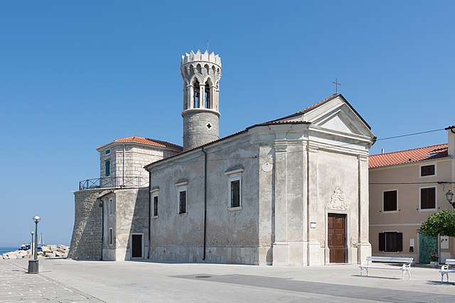
Deutsch: Nach einer Pestepidemie in Piran wurde die Kirche des hl Klemens in Maria Gesundheit umbenannt. Sie wurde schon im 13. Jahrhundert erwähnt und 1793 und 1890 umfassend renoviert. 1617 wurde an der Nordwestseite der Leuchtturm von Piran an die Kirche gebaut. English: In the 17th century after an epidemic plaque the church of st. Clement´s was renamed to a Our Lady of Health Church. The church was mentioned in the 13th century already and was renewed in 1793 and 1890. 1617 the Piran lighthouse was attached at the northwest side of the church. |
| Date | |
| Source | Own work |
| Author | Isiwal |
| Camera location |
| View this and other nearby images on: OpenStreetMap |
|
|---|
Licensing
I, the copyright holder of this work, hereby publish it under the following license:
This file is licensed under the
Creative Commons
Attribution-Share Alike 4.0 International license.
Attribution: Isiwal/Wikimedia Commons/CC BY-SA 4.0
- You are free:
- to share – to copy, distribute and transmit the work
- to remix – to adapt the work
- Under the following conditions:
- attribution – You must give appropriate credit, provide a link to the license, and indicate if changes were made. You may do so in any reasonable manner, but not in any way that suggests the licensor endorses you or your use.
- share alike – If you remix, transform, or build upon the material, you must distribute your contributions under the same or compatible license as the original.
This image has been assessed using the
Quality image guidelines and is considered a
Quality image.
|
File history
Click on a date/time to view the file as it appeared at that time.
| Date/Time | Thumbnail | Dimensions | User | Comment | |
|---|---|---|---|---|---|
| current | 20:04, 22 July 2015 |
| 5,456 × 3,637 (4.6 MB) | Isiwal | VicuñaUploader 1.20 |
File usage
The following pages on the English Wikipedia use this file (pages on other projects are not listed):
Global file usage
The following other wikis use this file:
- Usage on bs.wikipedia.org
- Usage on it.wikipedia.org
- Usage on mdf.wikipedia.org
- Usage on ru.wikivoyage.org
- Usage on sl.wikipedia.org
- Usage on www.wikidata.org