
Size of this PNG preview of this SVG file:
800 × 600 pixels. Other resolutions:
320 × 240 pixels |
640 × 480 pixels |
1,024 × 768 pixels |
1,280 × 960 pixels |
2,560 × 1,920 pixels.
Original file (SVG file, nominally 800 × 600 pixels, file size: 152 KB)
| This is a file from the
Wikimedia Commons. Information from its
description page there is shown below. Commons is a freely licensed media file repository. You can help. |
Summary
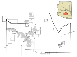
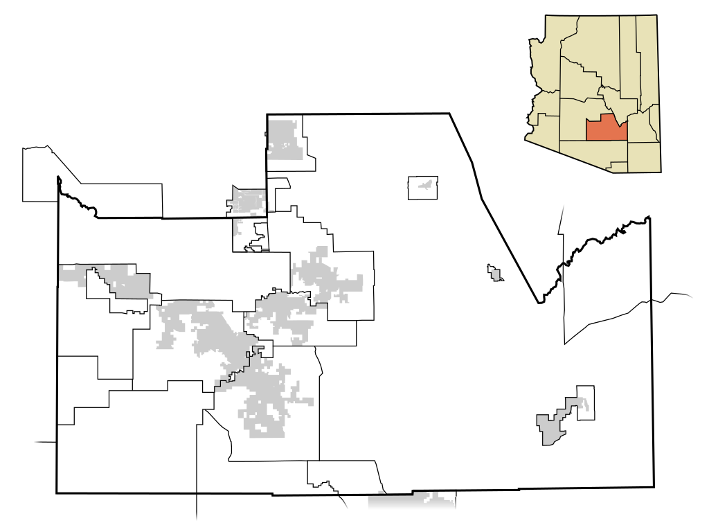
| Description | This map shows the incorporated areas and unincorporated areas in Pinal County, Arizona. Other incorporated cities are shown in gray, planning area borders for these cities and Indian reservation borders are shown as solid black lines. Map data is based on the following files as noted, all of which are .pdf files: * Pinal County 2008 Comprehensive Plan Amendments ( .pdf) - For determining incorporated and Indian reservation boundaries. * CAAG Pinal Planning Commissioners Presentation ( .pdf) - For determining planning area boundaries in Pinal County. * CAAG Population Estimates for Pinal County Places ( .pdf) - For determining boundaries of unincorporated areas in Pinal County. Additional data for cities shown are based on individual files from each city's Website. (Please view the category page for links to these files.) I created this map in Inkscape. Please Note: This file replaces Image:Pinal County Incorporated areas.svg, which is now obsolete! |
| Date | |
| Source | My own work, based on public domain information |
| Author | Ixnayonthetimmay |
| Permission ( Reusing this file) |
Public Domain |
| Other versions | See Category:Maps of Pinal County for other versions of this image. |
== Licensing ==
| I, the copyright holder of this work, release this work into the
public domain. This applies worldwide. In some countries this may not be legally possible; if so: I grant anyone the right to use this work for any purpose, without any conditions, unless such conditions are required by law. |
File history
Click on a date/time to view the file as it appeared at that time.
| Date/Time | Thumbnail | Dimensions | User | Comment | |
|---|---|---|---|---|---|
| current | 05:51, 8 July 2009 |
| 800 × 600 (152 KB) | Ixnayonthetimmay | == Summary == {{Information |Description=This map shows the incorporated areas and unincorporated areas in Pinal County, Arizona. [[:en:Top-of-the-World, Arizon |
| 16:47, 19 April 2008 |
 | 800 × 600 (160 KB) | Ixnayonthetimmay | == Summary == {{Information |Description=This map shows the incorporated areas and unincorporated areas in Pinal County, Arizona. Incorporated cities are shown |
File usage
The following pages on the English Wikipedia use this file (pages on other projects are not listed):
Global file usage
The following other wikis use this file:
- Usage on ja.wikipedia.org
- Usage on pt.wikipedia.org