No higher resolution available.
Philippines_area_map.jpg (402 × 405 pixels, file size: 44 KB, MIME type: image/jpeg)
| This is a file from the
Wikimedia Commons. Information from its
description page there is shown below. Commons is a freely licensed media file repository. You can help. |
Summary
| Description |
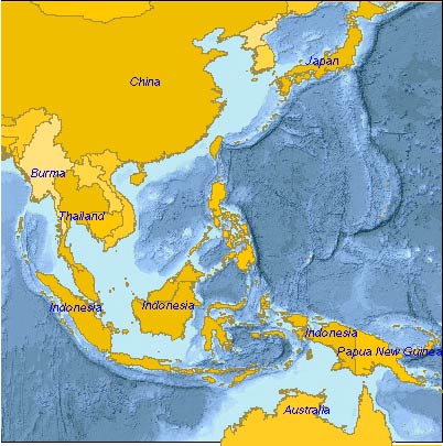
English: Area map centered on the Philippines, showing nearby countries |
| Date | |
| Source | Adobe Illustrator file created by mapping software at http://www.plainglobe.com, converted to JPEG file. |
| Author | Bill Mitchell (uploader), greatly aided by the mapping software |
| Permission ( Reusing this file) |
Planiglobe generated maps are issued under the Creative Commons Attribution-Share Alike 2.5 license. |
Licensing
This file is licensed under the
Creative Commons
Attribution-Share Alike 3.0 Unported license.
- You are free:
- to share – to copy, distribute and transmit the work
- to remix – to adapt the work
- Under the following conditions:
- attribution – You must give appropriate credit, provide a link to the license, and indicate if changes were made. You may do so in any reasonable manner, but not in any way that suggests the licensor endorses you or your use.
- share alike – If you remix, transform, or build upon the material, you must distribute your contributions under the same or compatible license as the original.
File history
Click on a date/time to view the file as it appeared at that time.
| Date/Time | Thumbnail | Dimensions | User | Comment | |
|---|---|---|---|---|---|
| current | 06:47, 3 November 2008 |
| 402 × 405 (44 KB) | Wtmitchell | {{Information |Description={{en|1=Area map centered on the Philippines, showing nearby countries}} |Source=Adobe Illustrator file created by mapping software at http://www.plainglobe.com, converted to JPEG file. |Author=Bill Mitchell (uploader), greatly a |
File usage
The following pages on the English Wikipedia use this file (pages on other projects are not listed):