
Size of this preview:
799 × 599 pixels. Other resolutions:
320 × 240 pixels |
640 × 480 pixels |
1,024 × 768 pixels |
1,280 × 960 pixels |
2,560 × 1,920 pixels |
3,430 × 2,573 pixels.
Original file (3,430 × 2,573 pixels, file size: 3.3 MB, MIME type: image/jpeg)
| This is a file from the
Wikimedia Commons. Information from its
description page there is shown below. Commons is a freely licensed media file repository. You can help. |
|
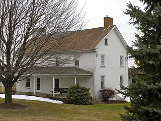
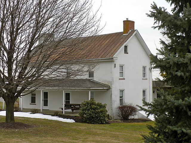
This is an image of a place or building that is listed on the
National Register of Historic Places in the
United States of America. Its reference number is
85002390. |
Summary
| Description |
English: Phillip Dougherty House (not to be confused with the Phillip Dougherty Tavern, or the Edward Dougherty House which are all NRHP listings in the area), on Strasburg Road in Chester County, PA. On the NRHP since September 18, 1985. Near Coatesville, Pa but in East Fallowfield Township. |
| Date | |
| Source | Own work |
| Author | Smallbones |
| Camera location |
| View this and other nearby images on: OpenStreetMap |
|
|---|
Licensing
| I, the copyright holder of this work, release this work into the
public domain. This applies worldwide. In some countries this may not be legally possible; if so: I grant anyone the right to use this work for any purpose, without any conditions, unless such conditions are required by law. |
File history
Click on a date/time to view the file as it appeared at that time.
| Date/Time | Thumbnail | Dimensions | User | Comment | |
|---|---|---|---|---|---|
| current | 17:32, 14 March 2010 |
| 3,430 × 2,573 (3.3 MB) | Smallbones | {{Information |Description={{en|1=Phillip Dougherty House (not to be confused with the Phillip Dougherty Tavern, or the Edward Dougherty House which are all NRHP listings in the area), on Strasburg Road in Chester County, PA. On the NRHP since September |
File usage
The following pages on the English Wikipedia use this file (pages on other projects are not listed):
Global file usage
The following other wikis use this file:
- Usage on www.wikidata.org