
Size of this preview:
800 × 503 pixels. Other resolutions:
320 × 201 pixels |
640 × 402 pixels |
1,024 × 644 pixels |
1,280 × 805 pixels |
2,560 × 1,610 pixels |
5,139 × 3,231 pixels.
Original file (5,139 × 3,231 pixels, file size: 5.26 MB, MIME type: image/jpeg)
| This is a file from the
Wikimedia Commons. Information from its
description page there is shown below. Commons is a freely licensed media file repository. You can help. |
Summary
| Description |
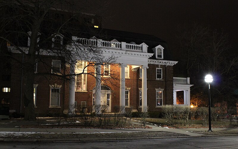
English: The Phi Delta Fraternity House on the University of Michigan campus. It was constructed in 1917. The fraternity was founded in 1869 at the University of Michigan.
|
||||
| Date | |||||
| Source | Own work | ||||
| Author | Dwight Burdette |
Licensing
I, the copyright holder of this work, hereby publish it under the following license:
This file is licensed under the
Creative Commons
Attribution 3.0 Unported license.
- You are free:
- to share – to copy, distribute and transmit the work
- to remix – to adapt the work
- Under the following conditions:
- attribution – You must give appropriate credit, provide a link to the license, and indicate if changes were made. You may do so in any reasonable manner, but not in any way that suggests the licensor endorses you or your use.
File history
Click on a date/time to view the file as it appeared at that time.
| Date/Time | Thumbnail | Dimensions | User | Comment | |
|---|---|---|---|---|---|
| current | 09:26, 22 March 2013 |
| 5,139 × 3,231 (5.26 MB) | Dwight Burdette | {{Information |Description ={{en|1=The Phi Delta Fraternity House on the University of Michigan campus. It was constructed in 1917. The fraternity was founded in 1869 at the University of Michigan. {{Location|42|16|27.34|N|83|44|33.80|W|}}}} |Source... |
File usage
The following pages on the English Wikipedia use this file (pages on other projects are not listed):
Global file usage
The following other wikis use this file:
- Usage on de.wikipedia.org