
Size of this preview:
767 × 600 pixels. Other resolutions:
307 × 240 pixels |
614 × 480 pixels |
982 × 768 pixels |
1,280 × 1,001 pixels |
2,200 × 1,720 pixels.
Original file (2,200 × 1,720 pixels, file size: 1.19 MB, MIME type: image/png)
| This is a file from the
Wikimedia Commons. Information from its
description page there is shown below. Commons is a freely licensed media file repository. You can help. |
Summary
| Description | |
| Date | |
| Source | Hal Jespersen’s Wikipedia Civil War Maps |
| Author | Drawn in Adobe Illustrator CS5 by Hal Jespersen. Graphic source file is available at http://www.posix.com/CWmaps/ |
Licensing
This file is licensed under the
Creative Commons
Attribution 3.0 Unported license.
Attribution: Map by Hal Jespersen, www.posix.com/CW
- You are free:
- to share – to copy, distribute and transmit the work
- to remix – to adapt the work
- Under the following conditions:
- attribution – You must give appropriate credit, provide a link to the license, and indicate if changes were made. You may do so in any reasonable manner, but not in any way that suggests the licensor endorses you or your use.
File history
Click on a date/time to view the file as it appeared at that time.
| Date/Time | Thumbnail | Dimensions | User | Comment | |
|---|---|---|---|---|---|
| current | 00:49, 27 March 2011 |
| 2,200 × 1,720 (1.19 MB) | Hlj | Updated to more recent graphics style. Added scale and legend. {{cc-by-3.0|Map by Hal Jespersen, www.posix.com/CW}} |
| 00:23, 4 March 2008 |
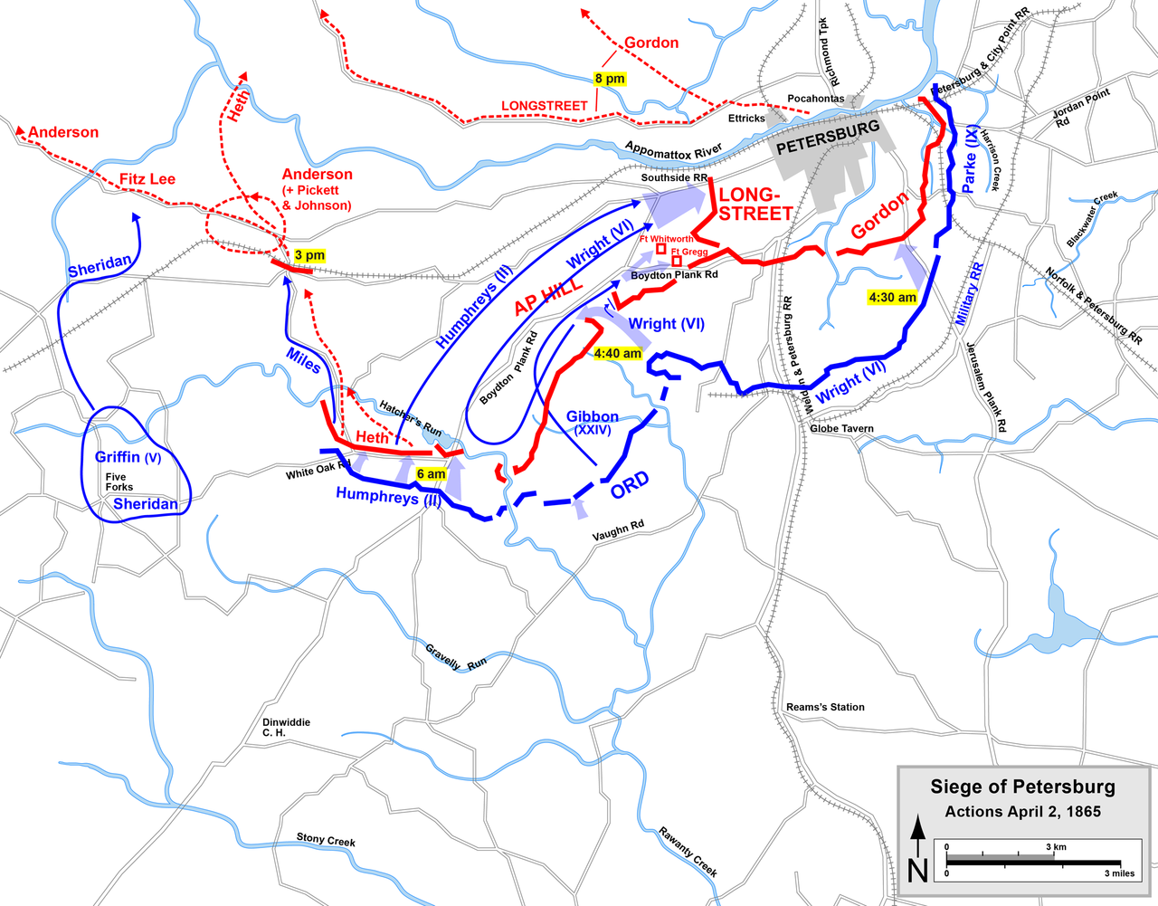
 | 3,720 × 2,877 (1.41 MB) | Lilyu | {{Information |Description=Map of start of Appomattox Campaign of the American Civil War, actions at Petersburg April 2, 1865. Drawn by Hal Jespersen in Macromedia Freehand. |Source=Graphic source file is available at http://www.posix.com/CWmaps/ |
File usage
The following pages on the English Wikipedia use this file (pages on other projects are not listed):
Global file usage
The following other wikis use this file:
- Usage on da.wikipedia.org
- Usage on es.wikipedia.org
- Usage on fr.wikipedia.org
- Usage on id.wikipedia.org
- Usage on it.wikipedia.org
- Usage on ja.wikipedia.org
- Usage on nl.wikipedia.org
- Usage on no.wikipedia.org
- Usage on pt.wikipedia.org
- Usage on ru.wikipedia.org
- Usage on sr.wikipedia.org
- Usage on vi.wikipedia.org