
Size of this preview:
800 × 403 pixels. Other resolutions:
320 × 161 pixels |
640 × 322 pixels |
1,024 × 516 pixels |
1,280 × 644 pixels |
2,187 × 1,101 pixels.
Original file (2,187 × 1,101 pixels, file size: 899 KB, MIME type: image/jpeg)
| This is a file from the
Wikimedia Commons. Information from its
description page there is shown below. Commons is a freely licensed media file repository. You can help. |
Summary
| Description |
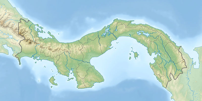
English: Physical location map of
Panama
Equirectangular projection. Geographic limits of the map:
Deutsch: Physische Positionskarte von
Panama
Quadratische Plattkarte. Geographische Begrenzung der Karte:
|
| Date | |
| Source |
Own work
|
| Author | Alexrk2 |
| Other versions |
|


|
This map has been made or improved in the German
Kartenwerkstatt (Map Lab). You can
propose maps to improve as well.
|
Licensing
I, the copyright holder of this work, hereby publish it under the following licenses:

|
Permission is granted to copy, distribute and/or modify this document under the terms of the GNU Free Documentation License, Version 1.2 or any later version published by the Free Software Foundation; with no Invariant Sections, no Front-Cover Texts, and no Back-Cover Texts. A copy of the license is included in the section entitled GNU Free Documentation License. |
This file is licensed under the
Creative Commons
Attribution-Share Alike 3.0 Unported license.
- You are free:
- to share – to copy, distribute and transmit the work
- to remix – to adapt the work
- Under the following conditions:
- attribution – You must give appropriate credit, provide a link to the license, and indicate if changes were made. You may do so in any reasonable manner, but not in any way that suggests the licensor endorses you or your use.
- share alike – If you remix, transform, or build upon the material, you must distribute your contributions under the same or compatible license as the original.
You may select the license of your choice.
| Annotations | This image is annotated: View the annotations at Commons |
File history
Click on a date/time to view the file as it appeared at that time.
| Date/Time | Thumbnail | Dimensions | User | Comment | |
|---|---|---|---|---|---|
| current | 18:04, 1 January 2014 |
| 2,187 × 1,101 (899 KB) | NordNordWest | + Panama Oeste |
| 16:21, 22 July 2009 |
 | 2,187 × 1,101 (785 KB) | Alexrk2 | Enhanced admin borders | |
| 14:00, 19 July 2009 |
 | 2,186 × 1,101 (774 KB) | Alexrk2 | changed dim | |
| 13:53, 19 July 2009 |
 | 2,186 × 1,101 (772 KB) | Alexrk2 | == Beschreibung == {{Information |Description={{en|1=Physical location map of Panama Equirectangular projection. Geographic limits of the map: * N: 10.28° N * S: 6.79° N * W: 83.56° W * O: 76.64° W}} {{de|1=Physische Positionskarte von |
File usage
More than 100 pages use this file. The following list shows the first 100 pages that use this file only. A full list is available.
- Alajuela Formation
- Alto de Nique
- Ancon Hill
- Balsas River (Panama)
- Barro Blanco Dam
- Bocas del Toro Archipelago
- Bocas del Toro Group
- Bohío Formation
- Bonyic Dam
- Buenaventura Classic
- Caimito Formation
- Calovebora River
- Caraba Formation
- Cascajal River
- Cerro Echandi
- Chagres Formation
- Chagres River
- Changuinola Dam
- Changuinola River
- Charco Azul Formation
- Chepo River
- Chiriquí Lagoon
- Chiriquí Viejo River
- Chucunaque River
- Coiba
- Colón Island
- Cucaracha Formation
- Culebra Formation
- Darién National Park
- Eastern Panamanian montane forests
- Ecnomiohyla thysanota
- El Valle (volcano)
- Escudo de Veraguas Formation
- Fortuna Dam
- Fortuna Forest Reserve
- Gatun Lake
- Gatuncillo Formation
- Gatún Formation
- Golfo de los Mosquitos
- Grande River (Panama)
- Guariviara River
- Isla Colón Formation
- Isla Gibraleón
- Jaqué River
- La Villa River
- La Yeguada
- List of fossiliferous stratigraphic units in Central America
- Mount Hope Formation
- Nancy Point Formation
- Okke Ornstein
- Old Bank Formation
- Pacora River
- Panama Championship
- Panama City
- Panama Formation
- Panama Masters
- Panama Open
- Picacho Mountain
- Rhinella acrolopha
- Rio Sidra
- Sabanas River
- Sambú River
- San Blas Islands
- San Felix River
- San Pablo River (Panama)
- Santa Ana, Panama City
- Santa María River (Panama)
- Serranía de Majé
- Serranía del Darién
- Shark Hole Point Formation
- Sixaola River
- Soberanía National Park
- Tabasara River
- Tobabe Formation
- Tonosí Formation
- Trams in Panama
- Tuira Formation
- Tuira River
- Urraca Formation
- Valiente Formation
- Volcán Barú
- User:Crtew/Darío Fernández Jaén
- User:GEbb4/sandbox/Draft of Trams in Panama
- User:Ty654/List of earthquakes from 1900-1949 exceeding magnitude 7+
- User:Ty654/List of earthquakes from 1920-1929 exceeding magnitude 6+
- User:Ty654/List of earthquakes from 1930-1939 exceeding magnitude 6+
- User:Ty654/List of earthquakes from 1940-1949 exceeding magnitude 6+
- User:Ty654/List of earthquakes from 1950-1954 exceeding magnitude 6+
- User:Ty654/List of earthquakes from 1950-1999 exceeding magnitude 7+
- User:Ty654/List of earthquakes from 1955-1959 exceeding magnitude 6+
- User:Ty654/List of earthquakes from 1960-1964 exceeding magnitude 6+
- User:Ty654/List of earthquakes from 1965-1969 exceeding magnitude 6+
- User:Ty654/List of earthquakes from 1975-1979 exceeding magnitude 6+
- User:Ty654/List of earthquakes from 1980-1984 exceeding magnitude 6+
- User:Ty654/List of earthquakes from 1985-1989 exceeding magnitude 6+
- User:Ty654/List of earthquakes from 1990-1994 exceeding magnitude 6+
- User:Ty654/List of earthquakes from 1995-1999 exceeding magnitude 6+
- User:Ty654/List of earthquakes from 2000-2004 exceeding magnitude 6+
- User:Ty654/List of earthquakes from 2005-2009 exceeding magnitude 6+
- User:Ty654/List of earthquakes from 2010-2014 exceeding magnitude 6+
View more links to this file.
Global file usage
The following other wikis use this file:
- Usage on als.wikipedia.org
- Usage on ar.wikipedia.org
- Usage on arz.wikipedia.org
- Usage on ast.wikipedia.org
- Usage on avk.wikipedia.org
- Usage on az.wikipedia.org
- Usage on ban.wikipedia.org
- Usage on ba.wikipedia.org
- Usage on be-tarask.wikipedia.org
- Usage on be.wikipedia.org
- Usage on bg.wikipedia.org
- Usage on bn.wikipedia.org
- Usage on bs.wikipedia.org
- Usage on ca.wikipedia.org
- Usage on ceb.wikipedia.org
- Usage on ce.wikipedia.org
- Usage on ckb.wikipedia.org
- Usage on cs.wikipedia.org
View more global usage of this file.