
Size of this preview:
800 × 474 pixels. Other resolutions:
320 × 190 pixels |
640 × 379 pixels |
1,024 × 607 pixels |
1,280 × 759 pixels |
1,950 × 1,156 pixels.
Original file (1,950 × 1,156 pixels, file size: 326 KB, MIME type: image/jpeg)
| This is a file from the
Wikimedia Commons. Information from its
description page there is shown below. Commons is a freely licensed media file repository. You can help. |
Summary
| Description |
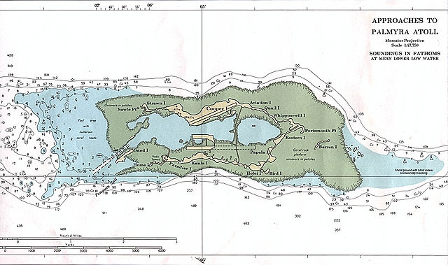
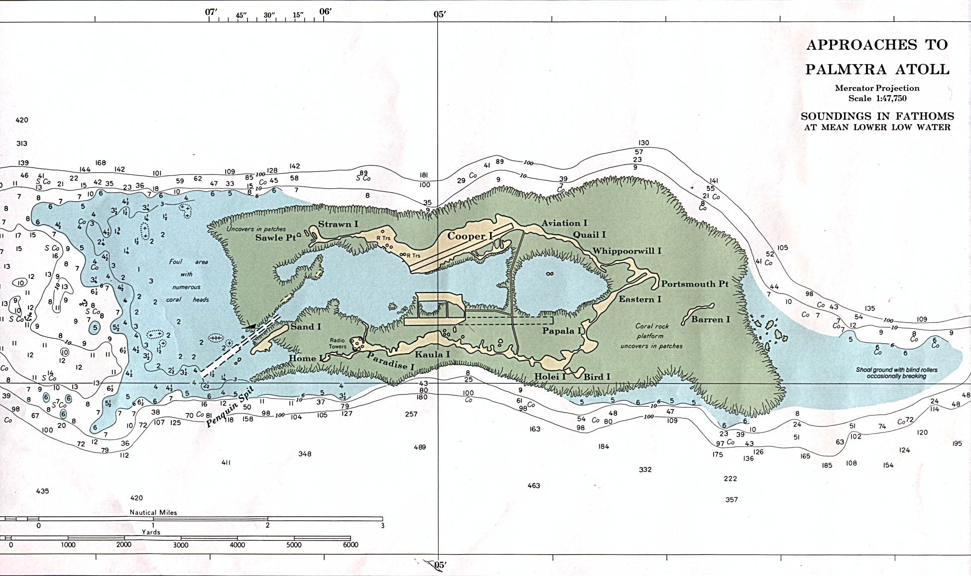
English: NOAA nautical chart of Palmyra Atoll. |
| Source | http://www.lib.utexas.edu/maps/islands_oceans_poles/palmyra_atoll_91.jpg |
| Author | NOAA |

|
This map image could be re-created using
vector graphics as an
SVG file. This has several advantages; see
Commons:Media for cleanup for more information. If an SVG form of this image is available, please upload it and afterwards replace this template with
{{
vector version available|new image name}}
.
It is recommended to name the SVG file “Palmyra atoll 91.svg”—then the template Vector version available (or Vva) does not need the new image name parameter. |


Licensing
This image is in the
public domain because it contains materials that originally came from the U.S.
National Oceanic and Atmospheric Administration, taken or made as part of an employee's official duties.
|
| Annotations | This image is annotated: View the annotations at Commons |
File history
Click on a date/time to view the file as it appeared at that time.
| Date/Time | Thumbnail | Dimensions | User | Comment | |
|---|---|---|---|---|---|
| current | 11:35, 3 January 2008 |
| 1,950 × 1,156 (326 KB) | Ratzer | NOAA Nautical Map, found on page http://www.lib.utexas.edu/maps/islands_oceans_poles/palmyra_atoll_91.jpg |
File usage
The following pages on the English Wikipedia use this file (pages on other projects are not listed):
Global file usage
The following other wikis use this file:
- Usage on de.wikipedia.org
- Usage on frr.wikipedia.org
- Usage on gl.wikipedia.org
- Usage on it.wikipedia.org
- Usage on ka.wikipedia.org
- Usage on ko.wikipedia.org
- Usage on ru.wikipedia.org
- Usage on scn.wikipedia.org
- Usage on su.wikipedia.org
- Usage on ta.wikipedia.org
- Usage on tr.wikipedia.org
- Usage on zh.wikipedia.org