
Size of this preview:
800 × 372 pixels. Other resolutions:
320 × 149 pixels |
640 × 297 pixels |
1,024 × 476 pixels |
1,280 × 595 pixels |
2,560 × 1,189 pixels |
4,733 × 2,199 pixels.
Original file (4,733 × 2,199 pixels, file size: 2 MB, MIME type: image/jpeg)
| This is a file from the
Wikimedia Commons. Information from its
description page there is shown below. Commons is a freely licensed media file repository. You can help. |
Summary
| Description |
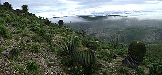
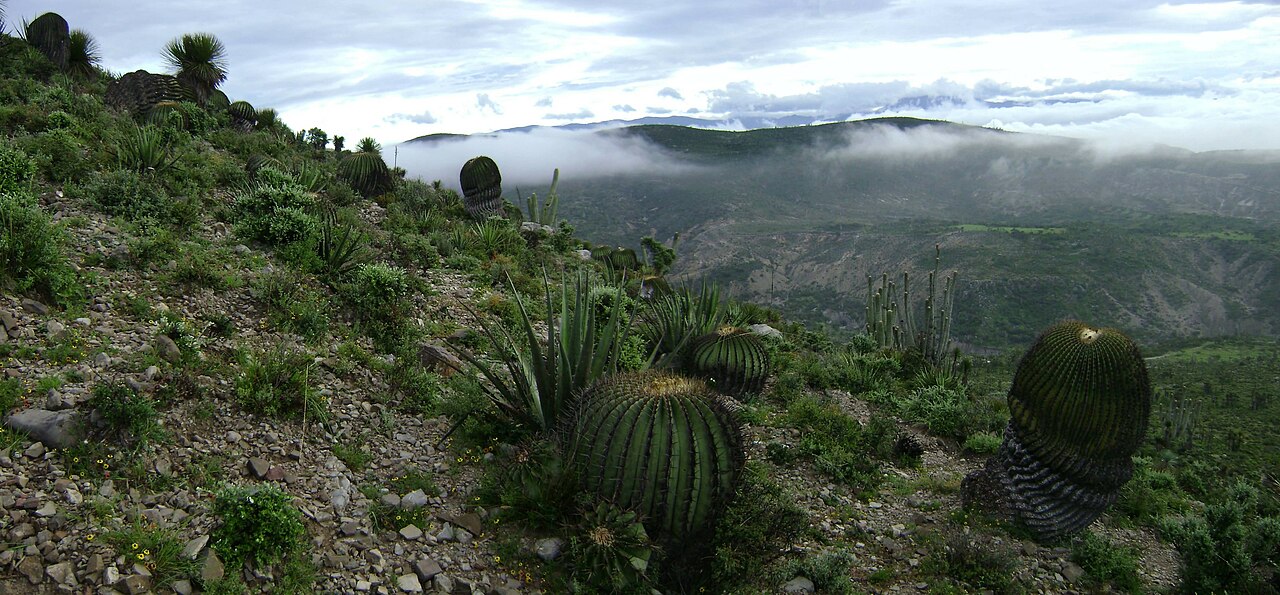
English: The landscape of the xeric
Tehuacán Valley matorral ecoregion, near San Antonio Texcala in
Puebla state, Central México.
Español: Paisaje de los montes cercanos a la población de San Antonio Texcala, en
Puebla, México.
|
| Date | |
| Source | Own work |
| Author | Luistlatoani |
| Camera location |
| View this and other nearby images on: OpenStreetMap |
|
|---|
Licensing
| I, the copyright holder of this work, release this work into the
public domain. This applies worldwide. In some countries this may not be legally possible; if so: I grant anyone the right to use this work for any purpose, without any conditions, unless such conditions are required by law. |
File history
Click on a date/time to view the file as it appeared at that time.
| Date/Time | Thumbnail | Dimensions | User | Comment | |
|---|---|---|---|---|---|
| current | 00:18, 21 October 2010 |
| 4,733 × 2,199 (2 MB) | Luistlatoani | {{Information |Description={{es|1=Paisaje de los montes cercanos a la población de San Antonio Texcala, en Puebla, México. Esta zona forma parte de la Reserva de la Biósfera Tehuacán-Cuicatlán, una zona ecológica protegida que cuenta con especies an |
File usage
The following pages on the English Wikipedia use this file (pages on other projects are not listed):
Global file usage
The following other wikis use this file:
- Usage on arz.wikipedia.org
- Usage on cs.wikipedia.org
- Usage on de.wikipedia.org
- Usage on en.wikivoyage.org
- Usage on eo.wikipedia.org
- Usage on es.wikipedia.org
- Usage on fa.wikipedia.org
- Usage on fi.wikibooks.org
- Usage on fr.wikipedia.org
- Usage on fr.wikivoyage.org
- Usage on gl.wikipedia.org
- Usage on he.wikipedia.org
- Usage on hr.wikipedia.org
- Usage on hu.wikipedia.org
- Usage on it.wikipedia.org
- Usage on it.wikivoyage.org
- Usage on lt.wikipedia.org
- Usage on mk.wikipedia.org
- Usage on mt.wikipedia.org
- Usage on nl.wikipedia.org
- Usage on pl.wikipedia.org
- Usage on pt.wikipedia.org
- Usage on ru.wikipedia.org
- Usage on sk.wikipedia.org
- Usage on th.wikipedia.org
- Usage on tr.wikipedia.org
- Usage on uk.wikipedia.org
- Usage on vi.wikipedia.org
- Usage on www.wikidata.org
- Usage on zh.wikivoyage.org