
Size of this PNG preview of this SVG file:
494 × 600 pixels. Other resolutions:
198 × 240 pixels |
395 × 480 pixels |
633 × 768 pixels |
843 × 1,024 pixels |
1,687 × 2,048 pixels |
1,108 × 1,345 pixels.
Original file (SVG file, nominally 1,108 × 1,345 pixels, file size: 302 KB)
| This is a file from the
Wikimedia Commons. Information from its
description page there is shown below. Commons is a freely licensed media file repository. You can help. |
Summary
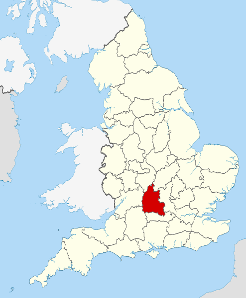
| Description | Location of the ceremonial county of Oxfordshire within England. |
| Date | |
| Source |
National Geospatial-Intelligence Agency
|
| Author | Nilfanion |
Licensing
I, the copyright holder of this work, hereby publish it under the following licenses:
This file is licensed under the
Creative Commons
Attribution-Share Alike 3.0 Unported license.
- You are free:
- to share – to copy, distribute and transmit the work
- to remix – to adapt the work
- Under the following conditions:
- attribution – You must give appropriate credit, provide a link to the license, and indicate if changes were made. You may do so in any reasonable manner, but not in any way that suggests the licensor endorses you or your use.
- share alike – If you remix, transform, or build upon the material, you must distribute your contributions under the same or compatible license as the original.

|
Permission is granted to copy, distribute and/or modify this document under the terms of the GNU Free Documentation License, Version 1.2 or any later version published by the Free Software Foundation; with no Invariant Sections, no Front-Cover Texts, and no Back-Cover Texts. A copy of the license is included in the section entitled GNU Free Documentation License. |
You may select the license of your choice.

|
This is one of the images forming part of the
Valued image set:
Locator maps of the Ceremonial counties of England on Wikimedia Commons. The image set has been assessed under the
valued image set criteria and is considered the most valued set on Commons within the scope:
Locator maps of the
Ceremonial counties of England
You can see its nomination at Commons:Valued image candidates/Locator maps of English ceremonial counties. |
File history
Click on a date/time to view the file as it appeared at that time.
| Date/Time | Thumbnail | Dimensions | User | Comment | |
|---|---|---|---|---|---|
| current | 22:25, 23 November 2010 |
| 1,108 × 1,345 (302 KB) | Nilfanion | use ceremonial counties - corresponds with text of article better |
| 16:39, 23 November 2010 |
 | 1,108 × 1,345 (332 KB) | Nilfanion | Fix coast - add Arran | |
| 00:47, 16 November 2010 |
 | 1,108 × 1,345 (325 KB) | Nilfanion | thicker lines | |
| 00:44, 16 November 2010 |
 | 1,108 × 1,345 (325 KB) | Nilfanion | {{Information |Description=Location of Oxfordshire within England, with the administrative counties shown. |Source= Ordnance Survey [https://www.ordnancesurvey.co.uk/opendatadownload/products.html OpenData]: *County |
File usage
More than 100 pages use this file. The following list shows the first 100 pages that use this file only. A full list is available.
- Abingdon Road
- Alfred Street
- Alice's Shop
- Angel & Greyhound Meadow, Oxford
- Ardington
- Aston, Cote, Shifford and Chimney
- Aston Upthorpe
- Badbury Hill
- Barford St. John and St. Michael
- Barton, Oxfordshire
- Battle Edge
- Bear Lane
- Beckley and Stowood
- Belbroughton Road
- Bix and Assendon
- Blenheim, Oxfordshire
- Blue Boar Street
- Bourton, Cherwell
- Brasenose Lane
- Brightwell Barrow
- Bruern
- Bullingdon Hundred
- Canterbury Road
- Caversham Lakes
- Charlbury Road
- Compton Beauchamp
- Cowley Road, Oxford
- Cumnor Hill
- Curbridge, Oxfordshire
- Dame's Delight
- Donnington, Oxfordshire
- Dragon Hill, Uffington
- Dunsden Green
- Examination Schools
- Farmoor
- Farmoor Reservoir
- Fencott and Murcott
- Founders Tower
- Gallowstree Common
- Golden Cross, Oxford
- Gosford and Water Eaton
- Grimsbury Reservoir
- Hanney
- Headington Hill
- Headington Road
- Hinksey
- Hinksey Hill
- Keble Road
- King Edward Street
- Kingston Blount
- Kingston Road, Oxford
- Logic Lane covered bridge
- Longwall Street
- Magdalen Street
- Magpie Lane, Oxford
- Market Street, Oxford
- Marston Ferry Road
- Mill Meadows, Henley-on-Thames
- Milton-under-Wychwood
- Municipal Borough of Abingdon
- Museum Road
- Noke, Oxfordshire
- Norham Gardens
- North Newington
- Oriel Square
- Oxford MSA
- Oxfordshire
- Peckwater Quadrangle
- Pembroke Square, Oxford
- Pembroke Street, Oxford
- Ploughley Rural District
- Queen Street, Oxford
- RAF Bampton Castle
- Radford, Oxfordshire
- Rainbow Bridge, Oxford
- Redgrave Pinsent Rowing Lake
- Risinghurst and Sandhills
- River Evenlode
- Roke
- Salford, Oxfordshire
- Science Area, Oxford
- South Hinksey
- South Parade
- South Parks Road
- South Weston
- St. Ebbes
- St Clement's, Oxford
- St Cross Road
- St John Street, Oxford
- St Michael's Street, Oxford
- Sunnymead
- Swinford, Oxfordshire
- Thames and Kennet Marina
- The Barley Mow, Clifton Hampden
- The Plain, Oxford
- The Trout Inn
- Trench Green
- Turf Tavern
- Waterperry
- Wellington Square, Oxford
View more links to this file.
Global file usage
The following other wikis use this file:
- Usage on af.wikipedia.org
- Usage on an.wikipedia.org
- Usage on ar.wikipedia.org
- Usage on arz.wikipedia.org
- Usage on ast.wikipedia.org
- Usage on be-tarask.wikipedia.org
- Usage on bg.wikipedia.org
- Usage on bn.wikipedia.org
- Usage on br.wikipedia.org
- Usage on ca.wikipedia.org
- Usage on ceb.wikipedia.org
- Usage on cs.wikipedia.org
- Usage on en.wikinews.org
- Usage on eo.wikipedia.org
- Usage on es.wikipedia.org
- Usage on et.wikipedia.org
- Usage on fa.wikipedia.org
- Usage on fi.wikipedia.org
- Usage on fr.wiktionary.org
- Usage on ga.wikipedia.org
- Usage on gl.wikipedia.org
- Usage on hak.wikipedia.org
- Usage on hr.wikipedia.org
- Usage on hu.wikipedia.org
- Usage on ia.wikipedia.org
- Usage on io.wikipedia.org
- Usage on ja.wikipedia.org
- Usage on ko.wikipedia.org
- Usage on la.wikipedia.org
- Usage on lld.wikipedia.org
- Usage on lt.wikipedia.org
- Usage on lv.wikipedia.org
- Usage on mr.wikipedia.org
- Usage on ms.wikipedia.org
View more global usage of this file.