Size of this preview:
392 × 599 pixels. Other resolutions:
157 × 240 pixels |
314 × 480 pixels |
502 × 768 pixels |
670 × 1,024 pixels |
1,594 × 2,436 pixels.
Original file (1,594 × 2,436 pixels, file size: 769 KB, MIME type: image/png)
| This is a file from the
Wikimedia Commons. Information from its
description page there is shown below. Commons is a freely licensed media file repository. You can help. |
Summary
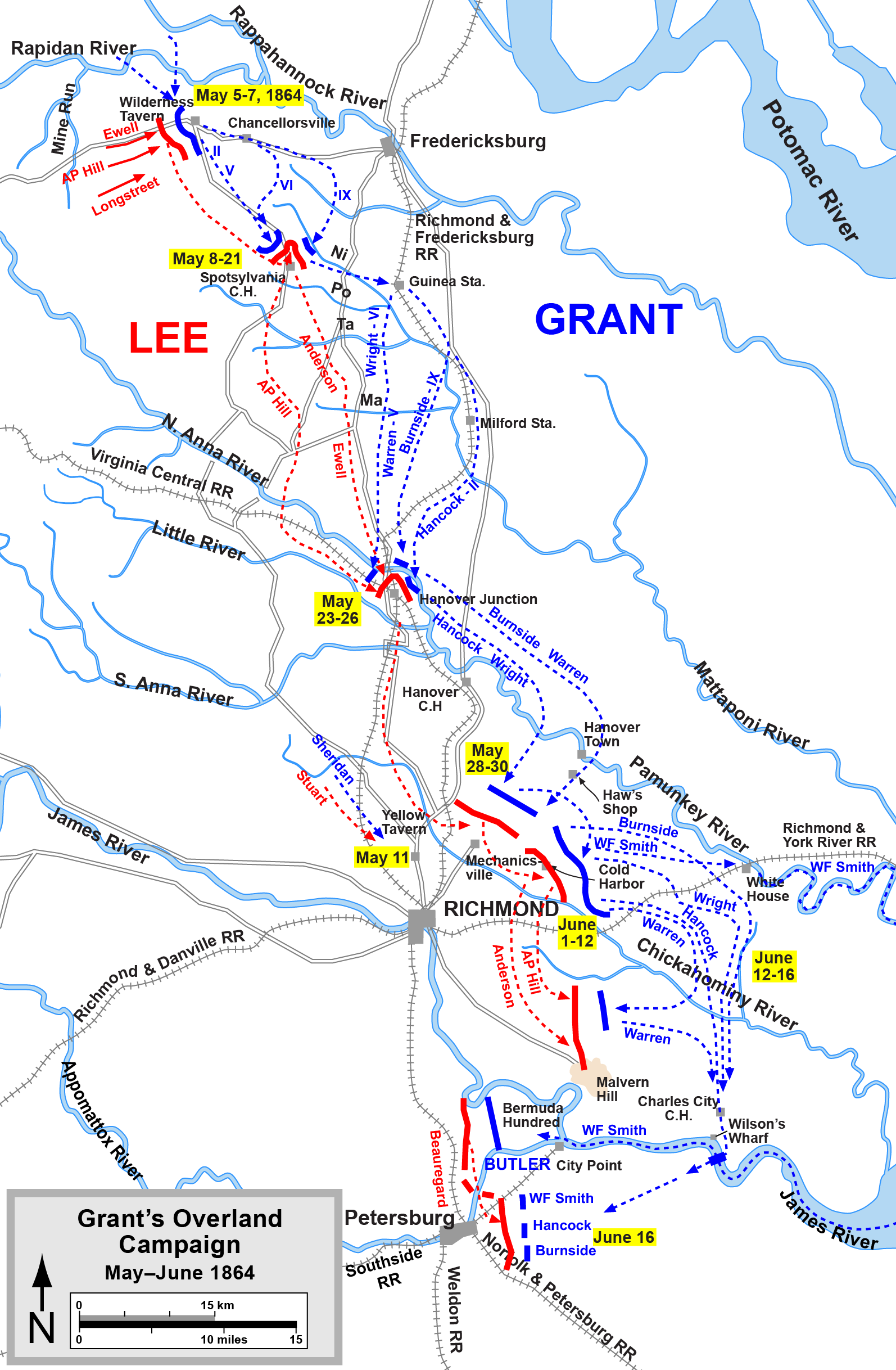
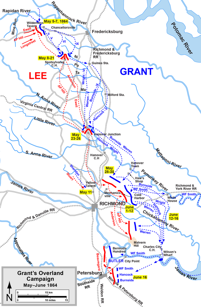
| Description | Overland Campaign |
| Source | Graphic source file is available at http://www.posix.com/CWmaps/ |
| Author | Drawn by Hal Jespersen in Adobe Illustrator CS5. |
Licensing
This file is licensed under the
Creative Commons
Attribution 3.0 Unported license.
Attribution: Map by Hal Jespersen, www.posix.com/CW
- You are free:
- to share – to copy, distribute and transmit the work
- to remix – to adapt the work
- Under the following conditions:
- attribution – You must give appropriate credit, provide a link to the license, and indicate if changes were made. You may do so in any reasonable manner, but not in any way that suggests the licensor endorses you or your use.
File history
Click on a date/time to view the file as it appeared at that time.
| Date/Time | Thumbnail | Dimensions | User | Comment | |
|---|---|---|---|---|---|
| current | 22:12, 16 April 2011 |
| 1,594 × 2,436 (769 KB) | Hlj | Add a label for Wilson's Wharf. Same license. |
| 21:45, 6 April 2011 |
 | 1,594 × 2,436 (766 KB) | Hlj | Added some more detail to the road network (needed for a related map). Same license. | |
| 20:01, 17 March 2011 |
 | 1,594 × 2,436 (739 KB) | Hlj | Minor graphical changes to conform to new ACW map style for roads and rivers. Same license. | |
| 20:57, 4 August 2010 |
 | 1,607 × 2,436 (667 KB) | Hlj | New version improves accuracy of unit positions and graphic style that matches others in the ACW series. Added legend box. Drawn by Hal Jespersen in Adobe Illustrator CS5. Graphic source file is available at http://www.posix.com/CWmaps/ {{cc-by-3.0|Map by | |
| 16:00, 16 November 2007 |
 | 757 × 1,165 (716 KB) | Hlj | {{Information |Description=Map of 1864 Overland Campaign |Source=self-made |Date=corrected typo November 16, 2007 |Author= Hlj |Permission= |other_versions= }} | |
| 07:33, 27 August 2006 |
 | 1,504 × 2,325 (874 KB) | Edmund Ferman |
File usage
No pages on the English Wikipedia use this file (pages on other projects are not listed).
Global file usage
The following other wikis use this file:
- Usage on da.wikipedia.org
- Usage on de.wikipedia.org
- Usage on es.wikipedia.org
- Usage on fi.wikipedia.org
- Usage on fr.wikipedia.org
- Usage on hu.wikipedia.org
- Usage on it.wikipedia.org
- Usage on ja.wikipedia.org
- Usage on la.wikipedia.org
- Usage on nl.wikipedia.org
- Usage on no.wikipedia.org
- Usage on pt.wikipedia.org
- Usage on ru.wikipedia.org
- Usage on vi.wikipedia.org