Size of this preview:
588 × 599 pixels. Other resolutions:
236 × 240 pixels |
471 × 480 pixels |
1,000 × 1,019 pixels.
Original file (1,000 × 1,019 pixels, file size: 1.25 MB, MIME type: image/png)
| This is a file from the
Wikimedia Commons. Information from its
description page there is shown below. Commons is a freely licensed media file repository. You can help. |

|
This map image could be re-created using
vector graphics as an
SVG file. This has several advantages; see
Commons:Media for cleanup for more information. If an SVG form of this image is available, please upload it and afterwards replace this template with
{{
vector version available|new image name}}
.
It is recommended to name the SVG file “Oregoncountry.svg”—then the template Vector version available (or Vva) does not need the new image name parameter. |
Summary
| Description |
English:
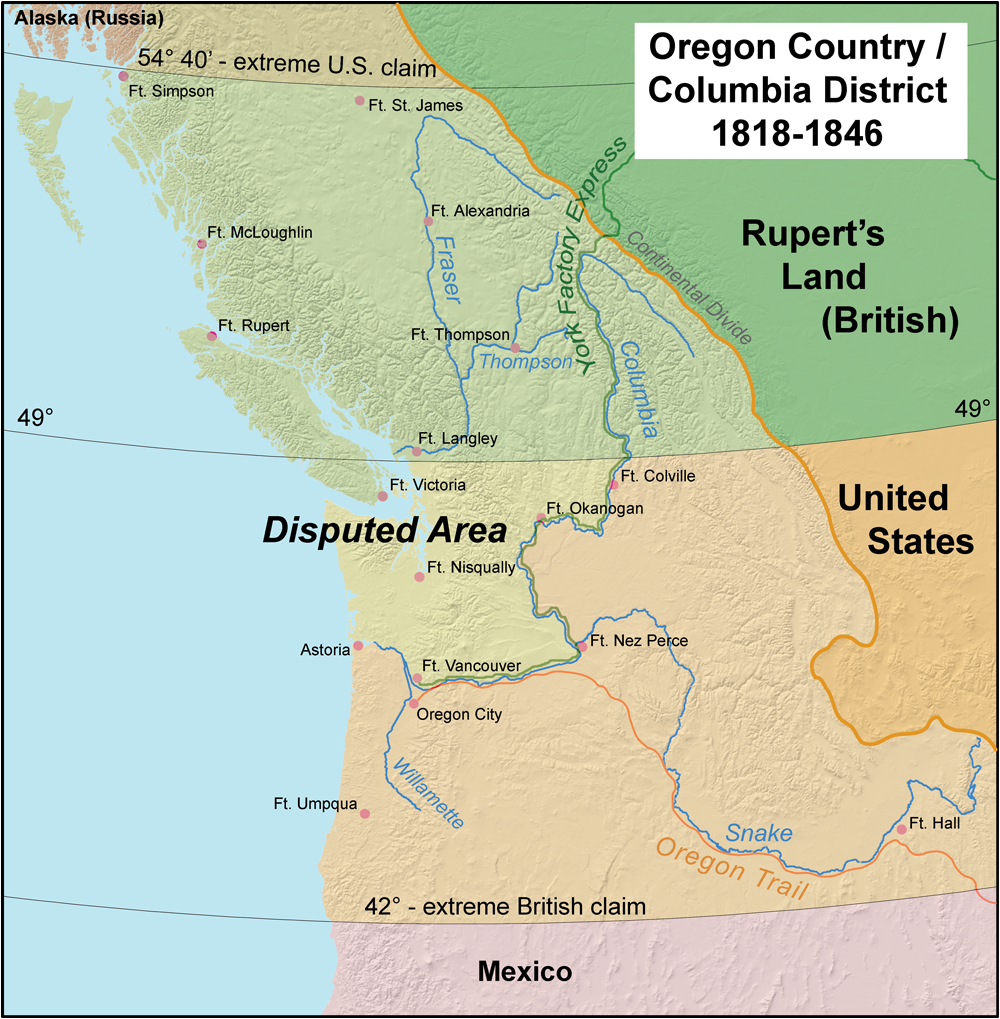
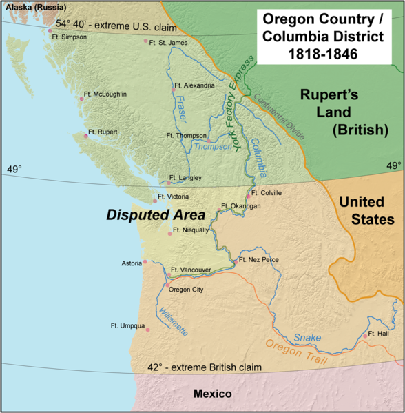
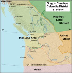
en:Oregon Country and the border dispute between the U.S. and Britain, 1818-1846. |
| Date | |
| Source | Own work |
| Author | Kmusser |
Licensing
I, the copyright holder of this work, hereby publish it under the following license:
This file is licensed under the
Creative Commons
Attribution-Share Alike 2.5 Generic license.
- You are free:
- to share – to copy, distribute and transmit the work
- to remix – to adapt the work
- Under the following conditions:
- attribution – You must give appropriate credit, provide a link to the license, and indicate if changes were made. You may do so in any reasonable manner, but not in any way that suggests the licensor endorses you or your use.
- share alike – If you remix, transform, or build upon the material, you must distribute your contributions under the same or compatible license as the original.
File history
Click on a date/time to view the file as it appeared at that time.
| Date/Time | Thumbnail | Dimensions | User | Comment | |
|---|---|---|---|---|---|
| current | 18:36, 28 August 2008 |
| 1,000 × 1,019 (1.25 MB) | Kmusser | Added York Factory Express and increased resolution |
| 12:41, 10 April 2006 |
 | 593 × 600 (139 KB) | Kmusser | ||
| 17:58, 6 April 2006 |
 | 593 × 600 (139 KB) | Kmusser | ||
| 16:52, 6 April 2006 |
 | 593 × 600 (135 KB) | Kmusser | ||
| 18:27, 5 April 2006 |
 | 593 × 600 (135 KB) | Kmusser | ||
| 16:53, 5 April 2006 |
 | 593 × 600 (135 KB) | Kmusser | ||
| 16:24, 5 April 2006 |
 | 593 × 600 (135 KB) | Kmusser | This map shows Oregon Country and the border dispute between the U.S. and Britain, 1818-1846. |
File usage
The following pages on the English Wikipedia use this file (pages on other projects are not listed):
Global file usage
The following other wikis use this file:
- Usage on ar.wikipedia.org
- Usage on ca.wikipedia.org
- Usage on cy.wikipedia.org
- Usage on de.wikipedia.org
- Usage on eo.wikipedia.org
- Usage on es.wikipedia.org
- Usage on fi.wikipedia.org
- Usage on he.wikipedia.org
- Usage on hi.wikipedia.org
- Usage on hy.wikipedia.org
- Usage on id.wikipedia.org
- Usage on io.wikipedia.org
- Usage on it.wikipedia.org
- Usage on ja.wikipedia.org
- Usage on ka.wikipedia.org
- Usage on ko.wikipedia.org
- Usage on lt.wikipedia.org
- Usage on nl.wikipedia.org
- Usage on no.wikipedia.org
- Usage on pl.wikipedia.org
- Usage on pt.wikipedia.org
- Usage on ro.wikipedia.org
- Usage on ru.wikipedia.org
- Usage on simple.wikipedia.org
View more global usage of this file.