
Size of this preview:
800 × 600 pixels. Other resolutions:
320 × 240 pixels |
640 × 480 pixels |
1,024 × 768 pixels |
1,280 × 960 pixels |
2,560 × 1,920 pixels |
3,371 × 2,528 pixels.
Original file (3,371 × 2,528 pixels, file size: 3.11 MB, MIME type: image/jpeg)
| This is a file from the
Wikimedia Commons. Information from its
description page there is shown below. Commons is a freely licensed media file repository. You can help. |
Summary
| Description |
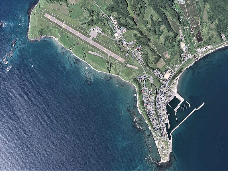
日本語: 奥尻空港および早苗地区付近の空中写真。CHO20173X-C4-12を使用作成。
English: Okushiri Airport Aerial photograph.2017 |
| Date | |
| Source | 国土情報ウェブマッピングシステム |
| Author | 国土地理院 |
Licensing

|
The copyright holder of this file, the Ministry of Land, Infrastructure, Transport and Tourism of Japan, allows anyone to use it for any purpose, provided that the copyright holder is properly attributed. Redistribution, derivative work, commercial use, and all other use is permitted. |
Attribution:
Copyright ©
National Land Image Information (Color Aerial Photographs), Ministry of Land, Infrastructure, Transport and Tourism
|
 |
This image is copyrighted by
the Ministry of Land, Infrastructure, Transport and Tourism of Japan. For terms of use, see
the stipulation to use of National Land Information (in Japanese) and
message from MLIT (in Japanese and English). When you display this image on an article, include the following phrase in the description: "Made based on
National Land Image Information (Color Aerial Photographs), Ministry of Land, Infrastructure, Transport and Tourism".
|
File history
Click on a date/time to view the file as it appeared at that time.
| Date/Time | Thumbnail | Dimensions | User | Comment | |
|---|---|---|---|---|---|
| current | 08:07, 18 September 2020 |
| 3,371 × 2,528 (3.11 MB) | さかおり | Uploaded a work by 国土地理院 from 国土情報ウェブマッピングシステム with UploadWizard |
File usage
The following pages on the English Wikipedia use this file (pages on other projects are not listed):
Global file usage
The following other wikis use this file:
- Usage on ja.wikipedia.org