Size of this preview:
800 × 328 pixels. Other resolutions:
320 × 131 pixels |
640 × 262 pixels |
1,325 × 543 pixels.
Original file (1,325 × 543 pixels, file size: 630 KB, MIME type: image/png)
| This is a file from the
Wikimedia Commons. Information from its
description page there is shown below. Commons is a freely licensed media file repository. You can help. |
Summary
| Description |
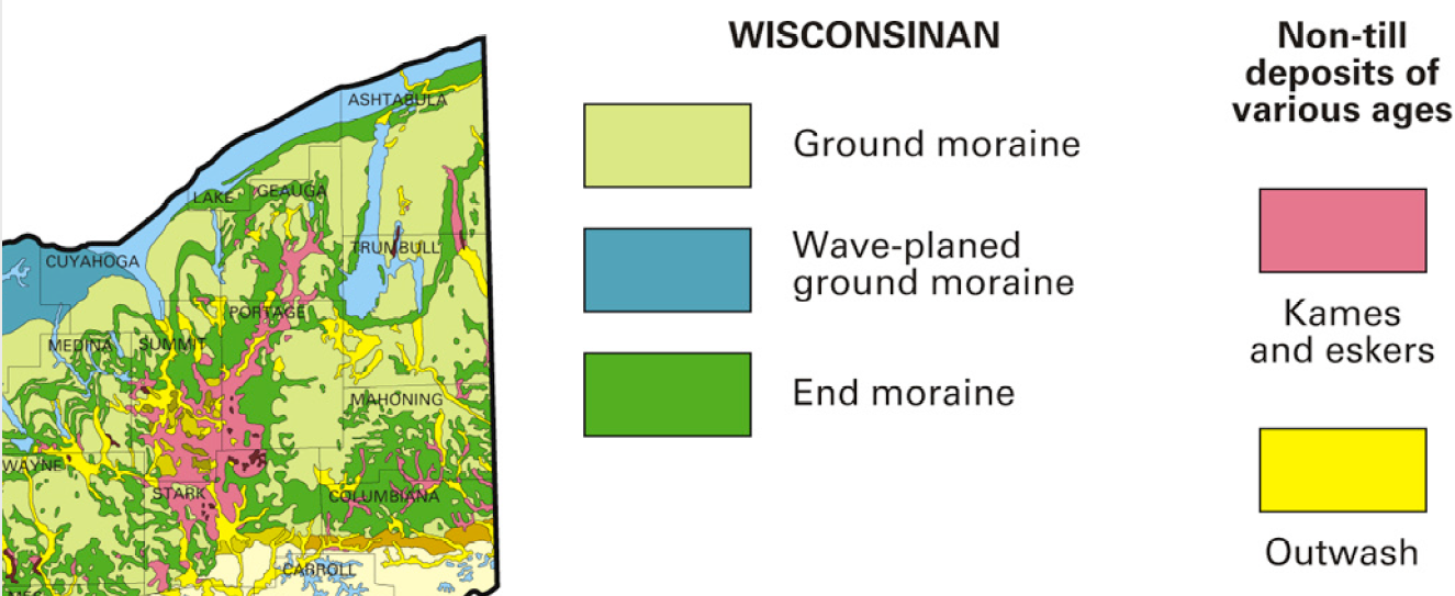
English: Ohio glacial geologic map |
| Date | |
| Source | Digital Mapping Techniques '06-workshop Proceedings, USGS Open File Report 2007-1285 |
| Author | David R. Soller (editor) |
Licensing
This image is in the
public domain in the United States because it only contains materials that originally came from the
United States Geological Survey, an agency of the
United States Department of the Interior. For more information, see
the official USGS copyright policy.
|
File history
Click on a date/time to view the file as it appeared at that time.
| Date/Time | Thumbnail | Dimensions | User | Comment | |
|---|---|---|---|---|---|
| current | 18:18, 19 September 2016 |
| 1,325 × 543 (630 KB) | Pi3.124 | User created page with UploadWizard |
File usage
The following pages on the English Wikipedia use this file (pages on other projects are not listed):
Global file usage
The following other wikis use this file:
- Usage on es.wikipedia.org
- Usage on he.wikipedia.org