
Size of this PNG preview of this SVG file:
378 × 545 pixels. Other resolutions:
166 × 240 pixels |
333 × 480 pixels |
533 × 768 pixels |
710 × 1,024 pixels |
1,420 × 2,048 pixels.
Original file (SVG file, nominally 378 × 545 pixels, file size: 749 KB)
| This is a file from the
Wikimedia Commons. Information from its
description page there is shown below. Commons is a freely licensed media file repository. You can help. |
Summary
| Description |
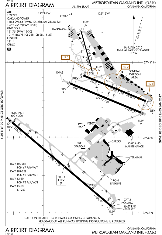
English: FAA Airport Diagram of airport: OAK |
| Date | |
| Source |
FAA Airport Diagrams; note that these change
every 28 days. Taken from PDF on FAA site and converted to SVG using en:Wikipedia:How to draw SVG circuits using Xcircuit. |
| Author | Produced by the National Aeronautical Charting Office (NACO), a department of the United States en:Federal Aviation Administration. |
| Camera location |
| View this and other nearby images on: OpenStreetMap |
|
|---|
W3C-validity not checked.
Licensing
This image or file is a work of a
Federal Aviation Administration employee, taken or made as part of that person's official duties. As a
work of the
U.S. federal government, the image is in the
public domain in the United States.
|
 |
File history
Click on a date/time to view the file as it appeared at that time.
| Date/Time | Thumbnail | Dimensions | User | Comment | |
|---|---|---|---|---|---|
| current | 20:29, 10 January 2017 |
| 378 × 545 (749 KB) | Grendelkhan | SVG version of FAA's PDF diagram. |
File usage
The following pages on the English Wikipedia use this file (pages on other projects are not listed):
Global file usage
The following other wikis use this file:
- Usage on de.wikipedia.org
- Usage on es.wikipedia.org
- Usage on ur.wikipedia.org
- Usage on www.wikidata.org