Size of this preview:
800 × 535 pixels. Other resolutions:
320 × 214 pixels |
640 × 428 pixels |
1,024 × 685 pixels |
1,280 × 856 pixels |
2,560 × 1,712 pixels |
3,951 × 2,643 pixels.
Original file (3,951 × 2,643 pixels, file size: 979 KB, MIME type: image/jpeg)
| This is a file from the
Wikimedia Commons. Information from its
description page there is shown below. Commons is a freely licensed media file repository. You can help. |
Summary
| Object location |
| View this and other nearby images on: OpenStreetMap |
|
|---|
| Description |
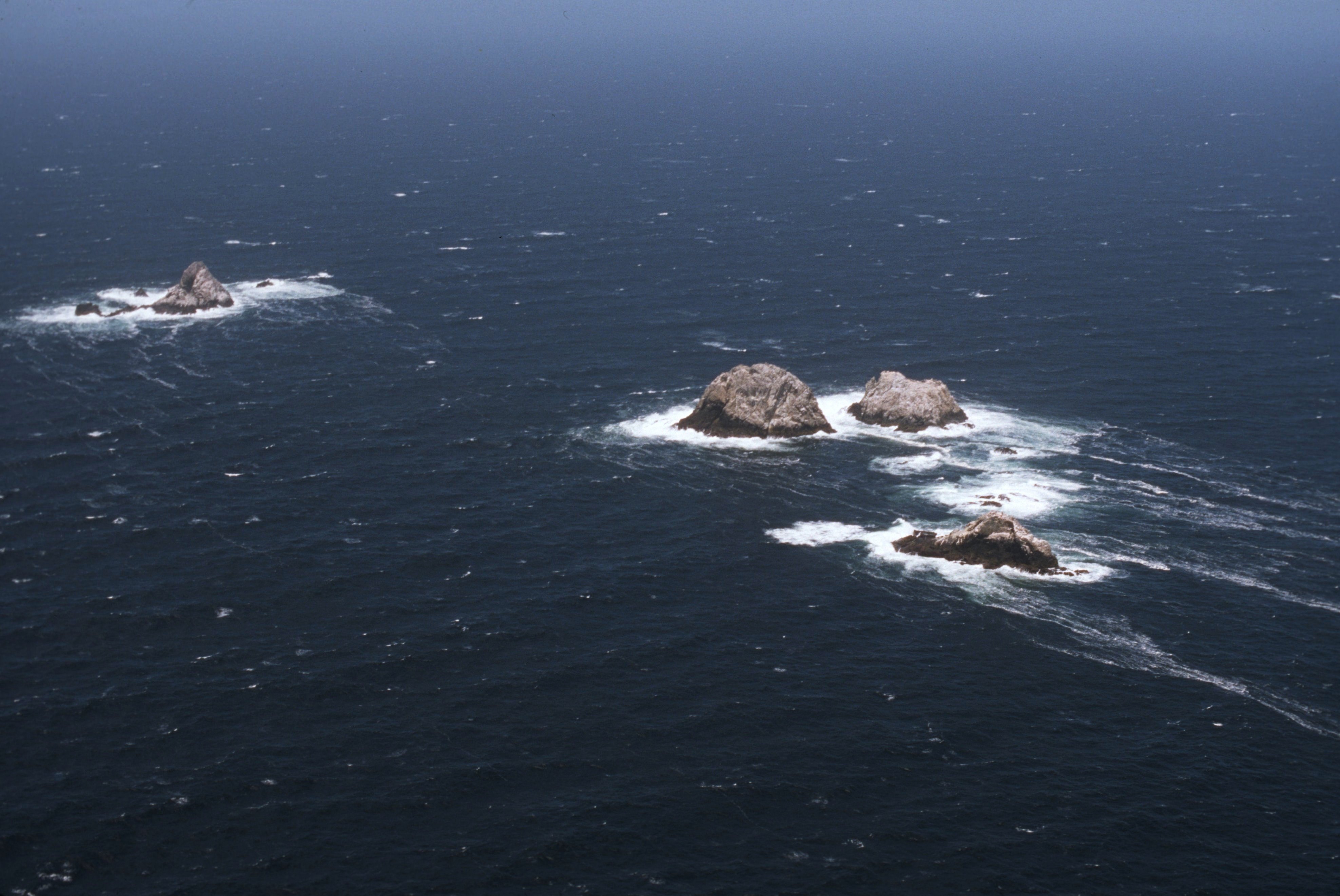
English: North Farallon Islands, part of the
Farallon Islands, a group of islands off the coast of San Francisco, California, USA (seen from south).
Deutsch: North Farallon Islands, Teil der
Farallon-Inseln, einer Inselgruppe vor der Küste San Franciscos, Kalifornien, USA (Blick von Süden).
|
|||
| Date | Unknown date | |||
| Source | http://www.photolib.noaa.gov/htmls/line4649.htm, http://www.photolib.noaa.gov/bigs/line4649.jpg | |||
| Author | Common Murre Restoration Project, USFWS (United States Fish and Wildlife Service) | |||
| Permission ( Reusing this file) |
|


|
This image has been assessed under the valued image criteria and is considered the most valued image on Commons within the scope: North Farallon Islands ( Farallon Islands). You can see its nomination here. |
| Annotations | This image is annotated: View the annotations at Commons |
File history
Click on a date/time to view the file as it appeared at that time.
| Date/Time | Thumbnail | Dimensions | User | Comment | |
|---|---|---|---|---|---|
| current | 11:46, 25 July 2013 |
| 3,951 × 2,643 (979 KB) | Thgoiter | {{Information |Description =North Farallon Islands |Source =http://www.photolib.noaa.gov/htmls/line4649.htm, http://www.photolib.noaa.gov/bigs/line4649.jpg |Author =Common Murre Restoration Project, USFWS (United States Fish and Wild... |
File usage
The following pages on the English Wikipedia use this file (pages on other projects are not listed):
Global file usage
The following other wikis use this file:
- Usage on de.wikipedia.org
- Usage on nl.wikipedia.org
- Usage on ru.wikipedia.org