Size of this preview:
776 × 600 pixels. Other resolutions:
311 × 240 pixels |
621 × 480 pixels |
994 × 768 pixels |
1,100 × 850 pixels.
Original file (1,100 × 850 pixels, file size: 1.21 MB, MIME type: image/png)
Summary
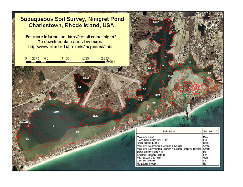
An example of a subaqueous soil landscape map of Ninigret Pond, Charlestown, Rhode Island, USA. Map created from data downloaded at: http://www.ci.uri.edu/projects/mapcoast/data/default.htm
Licensing
| This work is in the
public domain in the United States because it is a
work of the United States Federal Government under the terms of Title 17, Chapter 1, Section 105 of the
US Code. See
Copyright. Note: This only applies to works of the Federal Government and not to the work of any individual U.S. state, territory, commonwealth, county, municipality, or any other subdivision. This template also does not apply to postage stamp designs published by the United States Postal Service since 1978. (See 206.02(b) of Compendium II: Copyright Office Practices). |
 | This file is a candidate to be copied to
Wikimedia Commons.
Any user may perform this transfer; refer to Wikipedia:Moving files to Commons for details. If this file has problems with attribution, copyright, or is otherwise ineligible for Commons, then remove this tag and DO NOT transfer it; repeat violators may be blocked from editing. Other Instructions
| ||
| |||
File history
Click on a date/time to view the file as it appeared at that time.
| Date/Time | Thumbnail | Dimensions | User | Comment | |
|---|---|---|---|---|---|
| current | 13:51, 6 December 2006 |
 | 1,100 × 850 (1.21 MB) | Jimjet ( talk | contribs) | An example of a subaqueous soil landscape map of Ninigret Pond, Charlestown, Rhode Island, USA. Map created from data downloaded at: http://www.ci.uri.edu/projects/mapcoast/data/default.htm |
You cannot overwrite this file.
File usage
The following pages on the English Wikipedia use this file (pages on other projects are not listed):
