Size of this preview:
417 × 600 pixels. Other resolutions:
167 × 240 pixels |
334 × 480 pixels |
534 × 768 pixels |
712 × 1,024 pixels |
1,959 × 2,817 pixels.
Original file (1,959 × 2,817 pixels, file size: 1.95 MB, MIME type: image/jpeg)
| This is a file from the
Wikimedia Commons. Information from its
description page there is shown below. Commons is a freely licensed media file repository. You can help. |
Summary
| Description |
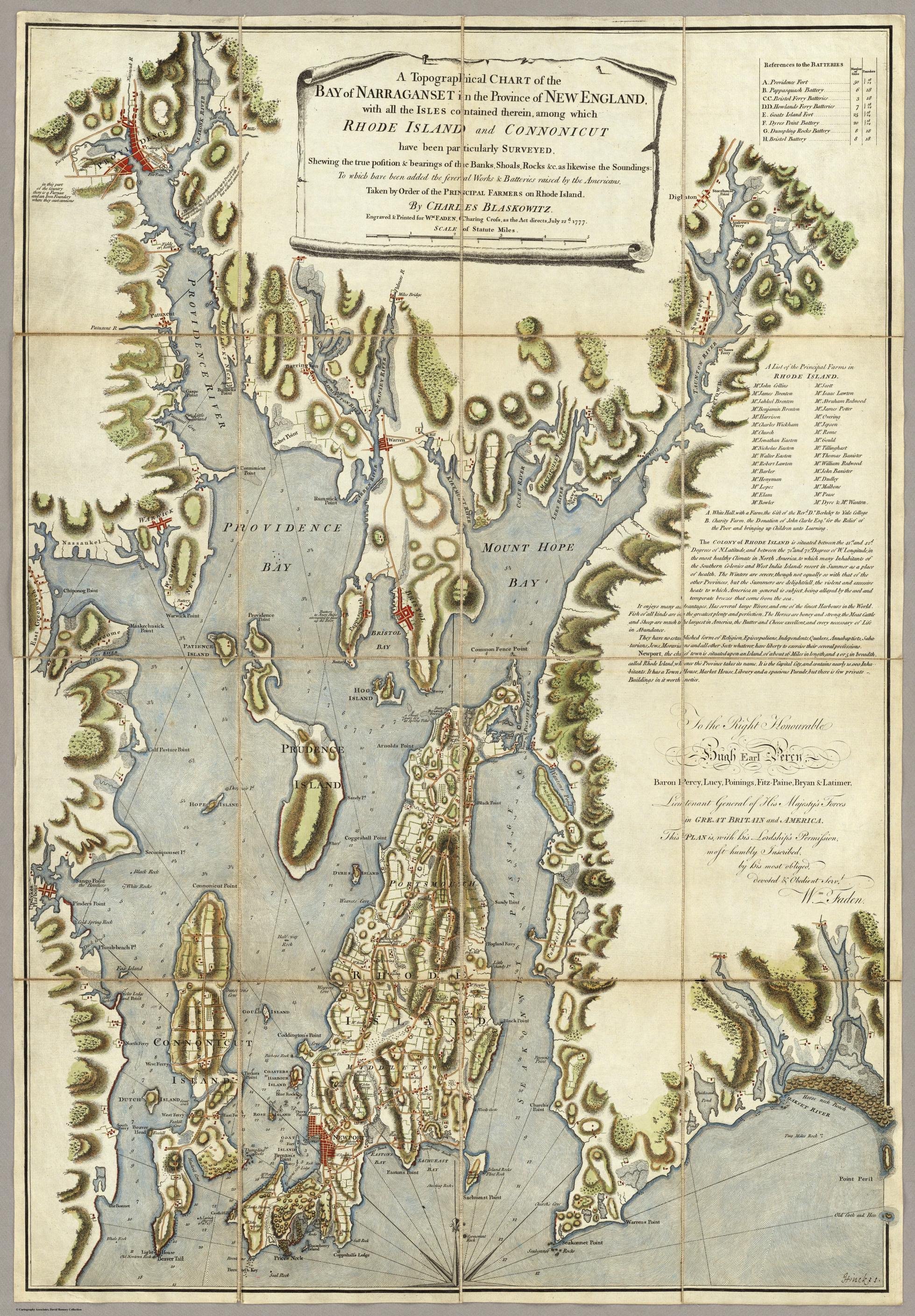
English: The Charles Blaskowitz Chart of Narragansett Bay published 1777 Charing Cross, London |
| Date | |
| Source | http://gaspee.org/Blaskowitz.htm |
| Author | Charles Blaskowitz by Commission of the Principal Farmer of Aquidneck Island 1777 |
| Camera location |
| View this and other nearby images on: OpenStreetMap |
|
|---|
Licensing
|
This work is in the public domain in its country of origin and other countries and areas where the copyright term is the author's life plus 70 years or fewer. This work is in the public domain in the United States because it was published (or registered with the U.S. Copyright Office) before January 1, 1929. | |
| This file has been identified as being free of known restrictions under copyright law, including all related and neighboring rights. | |
File history
Click on a date/time to view the file as it appeared at that time.
| Date/Time | Thumbnail | Dimensions | User | Comment | |
|---|---|---|---|---|---|
| current | 06:38, 11 November 2017 |
| 1,959 × 2,817 (1.95 MB) | Innapoy | User created page with UploadWizard |
File usage
The following pages on the English Wikipedia use this file (pages on other projects are not listed):