
Size of this preview:
800 × 553 pixels. Other resolutions:
320 × 221 pixels |
640 × 443 pixels |
1,024 × 708 pixels |
1,157 × 800 pixels.
Original file (1,157 × 800 pixels, file size: 271 KB, MIME type: image/jpeg)
| This is a file from the
Wikimedia Commons. Information from its
description page there is shown below. Commons is a freely licensed media file repository. You can help. |
Summary
| Description |
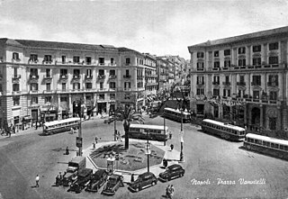
Italiano: Piazza Vanvitelli in una cartolina illustrata degli anni '50 |
| Date | 1950s |
| Source | Cartolina illustrata per uso postale |
| Author | Cartolina illustrata per uso postale |
| Camera location |
| View this and other nearby images on: OpenStreetMap |
|
|---|
Licensing
The
country of origin of this photograph is Italy. It is in the
public domain there because its copyright term has expired. According to
Law for the Protection of Copyright and Neighbouring Rights n.633, 22 April 1941 and later revisions, images of people or of aspects, elements and facts of natural or social life, obtained with photographic process or with an analogue one, including reproductions of figurative art and
film frames of
film stocks (Art. 87) are protected for a period of 20 years from creation (Art. 92). This provision shall not apply to photographs of writings, documents, business papers, material objects, technical drawings and similar products (Art. 87). Italian law makes an important distinction between "works of photographic art" and "simple photographs" (Art. 2, § 7). Photographs that are "intellectual work with creative characteristics" are protected for 70 years after the author's death (Art. 32 bis), whereas simple photographs are protected for a period of 20 years from creation.
|
 | |
 |
This may not apply in countries that don't apply the
rule of the shorter term to works from Italy. In particular, these are in the public domain in the United States only if:
|
This work is in the public domain in the United States because it meets three requirements:
For background information, see the explanations on
Non-U.S. copyrights.
Note: This tag should not be used for sound recordings. |
File history
Click on a date/time to view the file as it appeared at that time.
| Date/Time | Thumbnail | Dimensions | User | Comment | |
|---|---|---|---|---|---|
| current | 16:26, 15 April 2018 |
| 1,157 × 800 (271 KB) | Ruthven | unblurred version |
| 11:08, 5 September 2011 |
 | 1,100 × 770 (98 KB) | Liberonapoli |
File usage
The following pages on the English Wikipedia use this file (pages on other projects are not listed):
Global file usage
The following other wikis use this file:
- Usage on es.wikipedia.org
- Usage on fr.wikipedia.org
- Usage on it.wikipedia.org