No higher resolution available.
NOAA-_Outer_Banks.jpg (403 × 464 pixels, file size: 56 KB, MIME type: image/jpeg)
| This is a file from the
Wikimedia Commons. Information from its
description page there is shown below. Commons is a freely licensed media file repository. You can help. |
Summary
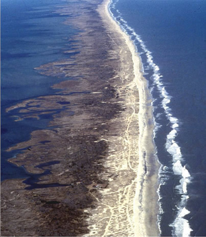
| Description |
English: Barrier island in the Outer Banks, North Carolina. |
| Source |
Site containing link to plane image file: http://www.csc.noaa.gov/beachnourishment/html/geo/barrier.htm Plain image file: http://www.csc.noaa.gov/beachnourishment/html/geo/images/a2f1.jpg |
| Author | NOAA |
Licensing
This image is in the
public domain because it contains materials that originally came from the U.S.
National Oceanic and Atmospheric Administration, taken or made as part of an employee's official duties.
|
File history
Click on a date/time to view the file as it appeared at that time.
| Date/Time | Thumbnail | Dimensions | User | Comment | |
|---|---|---|---|---|---|
| current | 04:01, 3 January 2009 |
| 403 × 464 (56 KB) | Yohmom | {{Information |Description={{en|1=Barrier island in the Outer Banks, North Carolina.}} |Source=Site containing link to plane image file: http://www.csc.noaa.gov/beachnourishment/html/geo/barrier.htm Plain image file: http://www.csc.noaa.gov/beachnourishme |
File usage
The following pages on the English Wikipedia use this file (pages on other projects are not listed):
Global file usage
The following other wikis use this file:
- Usage on fr.wikipedia.org
- Usage on ru.wikipedia.org
- Usage on uk.wikipedia.org
- Usage on zh.wikipedia.org