
Size of this preview:
607 × 600 pixels. Other resolutions:
243 × 240 pixels |
486 × 480 pixels |
975 × 963 pixels.
Original file (975 × 963 pixels, file size: 1.75 MB, MIME type: image/png)
| This is a file from the
Wikimedia Commons. Information from its
description page there is shown below. Commons is a freely licensed media file repository. You can help. |
Summary
| Description |
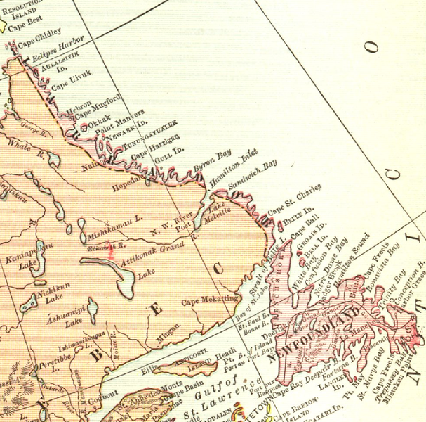
English: Map of Newfoundland and Labrador in 1912
Français : Carte de Terre-Neuve-et-Labrador en 1912 |
| Date | |
| Source | The New Student's Reference Work |
| Author | DOMINION OF CANADA AND NEWFOUNDLAND from The New Student's Reference Work. |

|
The author died in 1936, so this work is in the public domain in its country of origin and other countries and areas where the copyright term is the author's life plus 80 years or fewer. This work is in the public domain in the United States because it was published (or registered with the U.S. Copyright Office) before January 1, 1929. | |
| This file has been identified as being free of known restrictions under copyright law, including all related and neighboring rights. | |
File history
Click on a date/time to view the file as it appeared at that time.
| Date/Time | Thumbnail | Dimensions | User | Comment | |
|---|---|---|---|---|---|
| current | 18:30, 15 October 2011 |
| 975 × 963 (1.75 MB) | Zorion | {{Information |Description ={{en|1=Map of Newfoundland and Labrador in 1912}} |Source ={{own}} |Author = Zorion |Date = |Permission = |other_versions = }} Category:Maps of Newfoundland and Labrador |
File usage
The following pages on the English Wikipedia use this file (pages on other projects are not listed):
Global file usage
The following other wikis use this file:
- Usage on af.wikipedia.org
- Usage on ar.wikipedia.org
- Usage on az.wikipedia.org
- Usage on cs.wikipedia.org
- Usage on es.wikipedia.org
- Usage on fr.wikipedia.org
- Usage on fy.wikipedia.org
- Usage on it.wikipedia.org
- Usage on mt.wikipedia.org
- Usage on no.wikipedia.org
- Usage on ru.wikipedia.org
- Usage on sv.wikipedia.org
- Usage on uk.wikipedia.org
- Usage on www.wikidata.org